|
|
||||||
|
|
|
|
||||
|
|
||||||
|
|
|
|
||||
|
|
|
|
||||
|
|
|
|
||||
|
|
Ice Age Lake |
|
||||
|
|
|
|
||||
|
|
|
|
||||
|
|
|
|
||||
|
|
|
|
||||
|
|
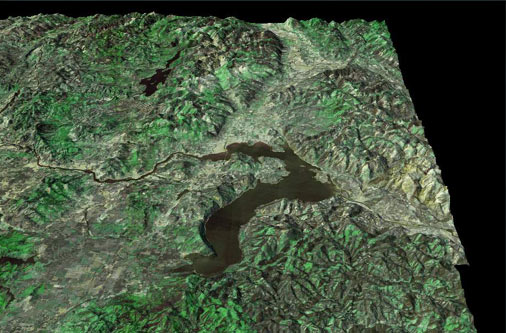
This image, combining USGS terrain data with a Landsat satellite image drape, shows the present-day area around Lake Pend Oreille in northern Idaho. This was the first area hit by floods coming from Glacial Lake Missoula, which lay just beyond the center right of this image, up the Clark Fork River. |
|
||||
|
|
||||||
|
|
|
|
||||
|
||||||