Before Watching
-
Use Google Earth to simulate what satellites "see" from
different distances from Earth.
Prior to launching "spy" satellites, the United States and the
USSR used high-altitude spy planes (such as the U2) and
developed camera and telescope imaging technology to take images
of ground facilities (see Spy Photos at
www.pbs.org/nova/astrospies/photos.html for influential
satellite photos from the past 40 years). Developers of the
manned orbital laboratory (MOL) hoped to supply continuous
reconnaissance.
Have students take their own turn at being a spy by using Google
Earth to inspect one of the following places:
-
your school parking lot (How many cars are in the faculty
lot?)
-
your local airport (How many planes are visible?)
-
a large U.S. airport such as Logan in Boston, JFK in New
York, or Dallas Ft-Worth (How many jets are visible?)
-
a naval yard or shipbuilding facility such as Bath Iron
Works in Bath, Maine (How many ships are being built?)
Have students take a screen shot and file a "spy" report about
the site (note that while the photos students will be looking at
are not real time, they do reveal what is going on at a specific
site at a point in time). Can they spot other vehicles, fuel
supplies, and hangars where weapons or planes could be stored?
-
Have students create a time line. The International Space
Station now orbiting Earth is a larger version of what the MOL
astronauts would have used to spy on military installations in
the Soviet Union. What were the steps that allowed the building
of a permanent orbiting research facility?
Have the class produce a space station time line. Assign one of
the following people or events that were crucial to the
development of rockets and space flight to each group. Have each
group summarize on a 5 x 8-inch file card what the event was and
why it was important. Have students download an image of the
person or craft associated with the event and paste it on the
other side of the card. Produce a time line (a string 7 meters
long) that starts at 1900 and ends at 2007. Have student groups
attach their cards at the appropriate place on the time line and
have each read their card descriptions to the class.
-
Orville and Wilbur Wright make first power-driven flight
(1903)
-
Robert Goddard creates the first working liquid-fuel rocket
(1926)
-
Werner von Braun builds two rockets that rise vertically for
more the than 2.4 kilometers (1934)
-
Chuck Yeager breaks the sound barrier in the Bell XS-1
(1947)
-
Major Arthur Murray sets altitude records of over 90,000
feet in the X1a aircraft (1954)
-
John Glenn becomes first man to orbit Earth (1962)
-
X-15 becomes first winged aircraft to attain velocities of
Mach 4, 5, and 6 (circa 1957)
-
WAC Corporal rocket becomes first U.S. missile to penetrate
outer space (1949)
-
Bell X-1A airplane achieves record altitude of 90,440 feet
(1954)
-
Russians launched Sputnik 1 satellite into space
(1957)
-
United States launches Explorer 1 satellite (1958)
Mercury space program (1959–63) Gemini space program (1965–66) -
Neil Armstrong becomes the first man to step on to the Moon
(1969)
Apollo space program (1961–75) -
Russian space station, Salyut (1971)
-
Almaz space station (secret spy station for USSR,
1971-78)
-
U.S. Skylab (1973–74)
-
Mir space station (USSR, 1986–99)
-
Begin assembly of International Space Station (ISS) in orbit
(1986)
First crew enters ISS (2000)
After Watching
-
Research satellite development. Sputnik I was the
first satellite placed into orbit by the Soviets in 1957. There
are now thousands of satellites in orbit around Earth. Organize
your class into groups and assign each group one of the
satellite types listed below. Each group should make a poster or
multimedia presentation that describes:
-
general size, weight, structure, what instruments it uses
-
primary user (science, military, industry) and specific
tasks
-
type of orbit and typical orbital path and height (see Links
and Books for information on types of orbits)
Encourage students to include graphics or models with their
presentations.
-
Astronomical satellites
satellites used for observation of distant planets,
galaxies, and other outer space objects
-
Biosatellites
satellites designed to carry living organisms, generally for
scientific experimentation
-
Communications satellites
satellites stationed in space for the purpose of
telecommunications
-
Navigational satellites
satellites that use radio time signals transmitted to enable
mobile receivers on the ground to determine their exact
location
-
Reconnaissance satellites
Earth observation satellite or communications satellite
deployed for military or intelligence applications
-
Earth observation satellites
satellites intended for non-military uses such as
environmental monitoring, meteorology, map making etc.
-
Space stations
human-made structures that are designed for people to live
on in outer space
-
Weather satellites
satellites that primarily are used to monitor Earth's
weather and climate
-
Explore resolution. To demonstrate what resolution means
and how important it is to see details, draw three, four, or
five dots on a piece of paper. They should be about 2 mm in
diameter and should be separated from each other by 4 to 5 mm,
center to center. The dots will represent rocket launchers as
seen from space. Tape the piece of paper in the front of the
room. Have the entire class stand up and line up across the back
the classroom (or do this activity in a hallway, gym, etc.).
Tell students to imagine they are using a telescope from space
to see rocket launchers. Here is an image (point to paper with
dots). Ask, "How many rocket launchers do you see?" Students
will see one large dot. Have students take one big step forward.
This action is equivalent to either going closer to the ground
with your spy telescope or increasing the resolution of your
telescope.
Repeat the process of students moving one large step and then
trying to guess (or see) how many rocket launchers are on the
paper. Students with keen eyesight will resolve the dots before
others.
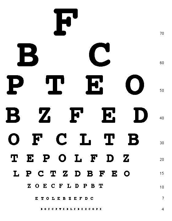
To demonstrate how sharper, or more detailed, resolution also
means that you can't see the bigger picture, download a dozen
eye charts (find one at
http://www.i-see.org/snellen.gif) and tape them to a wall of the room so that the middle of the
chart is close to eye level for most of the students. Cover them
up. Have students stand right up to the chart and then uncover
the charts. Have students write down what they see without
moving their heads. Have students take a step back and write
down what they see. Have students continue this process until
they are able to see the full eye chart. Repeat the process with
students who have not done it. Then discuss with the class the
advantages and disadvantages of being able to see objects more
closely.
-
Understanding dimensions. In this program, one of the
astronauts had to press his helmet down on his head to fit into
the MOL capsule. There was not much room to move around in any
of the early space vehicles. The MOL was to be a tube-shaped
capsule about 22 meters long with a diameter of 3.05 meters. The
actual cabin volume was projected to be only 11.3 meters3. How much space is this?
Part I: Have students come up with a list of what they consider
a small space to stand in at school or at home.
(Some spaces students may mention: bathroom stalls,
janitorial closets, hall closets, shower stalls.)
Have students measure these spaces and compute the volume of
space for each. Then have them compare this to the cabin volume
that was in the MOL capsule. How many cabins would fit into the
small space they measured?
Part II: Compute the volume of your classroom. Compare the
volume of your classroom with the size and volume of the ISS
(statistics given below). How many classrooms volumes equal the
present volume/working space in the International Space Station?
International Space Station Statistics
Current Mass (November 2007): 232,693 kg
Mass on completion:
471,736 kg
Length: 58.2 m along truss
Width: 44.5 m
Span of solar arrays:
73.15 m
Height: 27.4 m
Living volume:
424.75 m3 in a series of cylinders
Atmospheric pressure:
101.3 kPa
Perigee: 319.6 km
Apogee: 346.9 km
Orbit inclination:
51.63 degrees
Typical orbit altitude: 333.3 km
Average speed:
27,743.8 km/h
Orbital period:
91.20 minutes
Orbits per day:
15.79
Days in orbit: 3281 (2007-11-14)
Days occupied: 2570 (2007-11-14)

Links
NOVA—Astrospies
www.pbs.org/nova/astrospies
Features articles, interviews, interactive activities, and resources
to accompany the program.
The Best Laid Plans: A History of the Manned Orbiting Laboratory
www.aero.org/publications/crosslink/summer2004/02.html
Summarizes the history of the MOL program.
The Cuban Missile Crisis
www.classbrain.com/artteenst/publish/article_108.shtml
Provides details of the kind of evidence that precipitated the Cuban
missile crisis and an aerial photo of missiles in Cuba.
Earth's Atmosphere
liftoff.msfc.nasa.gov/academy/space/atmosphere.html
Provides details and diagrams of Earth's atmosphere and layers.
How Satellites Work
electronics.howstuffworks.com/satellite2.htm
Explains how satellites work and how they are launched, and
describes different types of satellite orbits and typical altitudes.
Stability and Control for the Manned Orbiting Laboratory
ntrs.nasa.gov/archive/nasa/casi.ntrs.nasa.gov/19650076610_1965076610.pdf
Features the original prospectus of the MOL in an article from the
1963 NASA archives.
Books
Countdown: A History of Space Flight
by T. A. Heppenheimer. J. Wiley & Sons, 1997.
Provides a history of spaceflight.
Space 50
by Piers Bizany. Smithsonian Books in association with
HarperCollins, 2006.
Features a history of spaceflight and a look into the future of
space flight.
Viewing Ideas Author
Jeff Lockwood taught high school astronomy, physics, and Earth
science for 28 years. He has authored numerous curriculum projects
and has provided instruction on curriculum development and science
teaching methods for more than a decade.
|

|
