
After boarding three commercial flights, one Air Force C17, and traveling for nearly 33 hours, I finally arrived in one of the most remote places on Earth: Antarctica. For the next five weeks, I will be based out of a small field camp in the western part of the continent called Byrd (named after the great Antarctic explorer Richard Byrd) to begin working on part of a project called POLENET, or the Polar Earth Observing Network. This particular project involves collecting GPS and seismic data that will help answer questions about the structure of the continent, the behavior of the Antarctic ice sheet, and how these may be related. My role will be to work primarily with the seismic instrumentation in West Antarctica, helping to collect data and perform any necessary maintenance on already installed instruments.
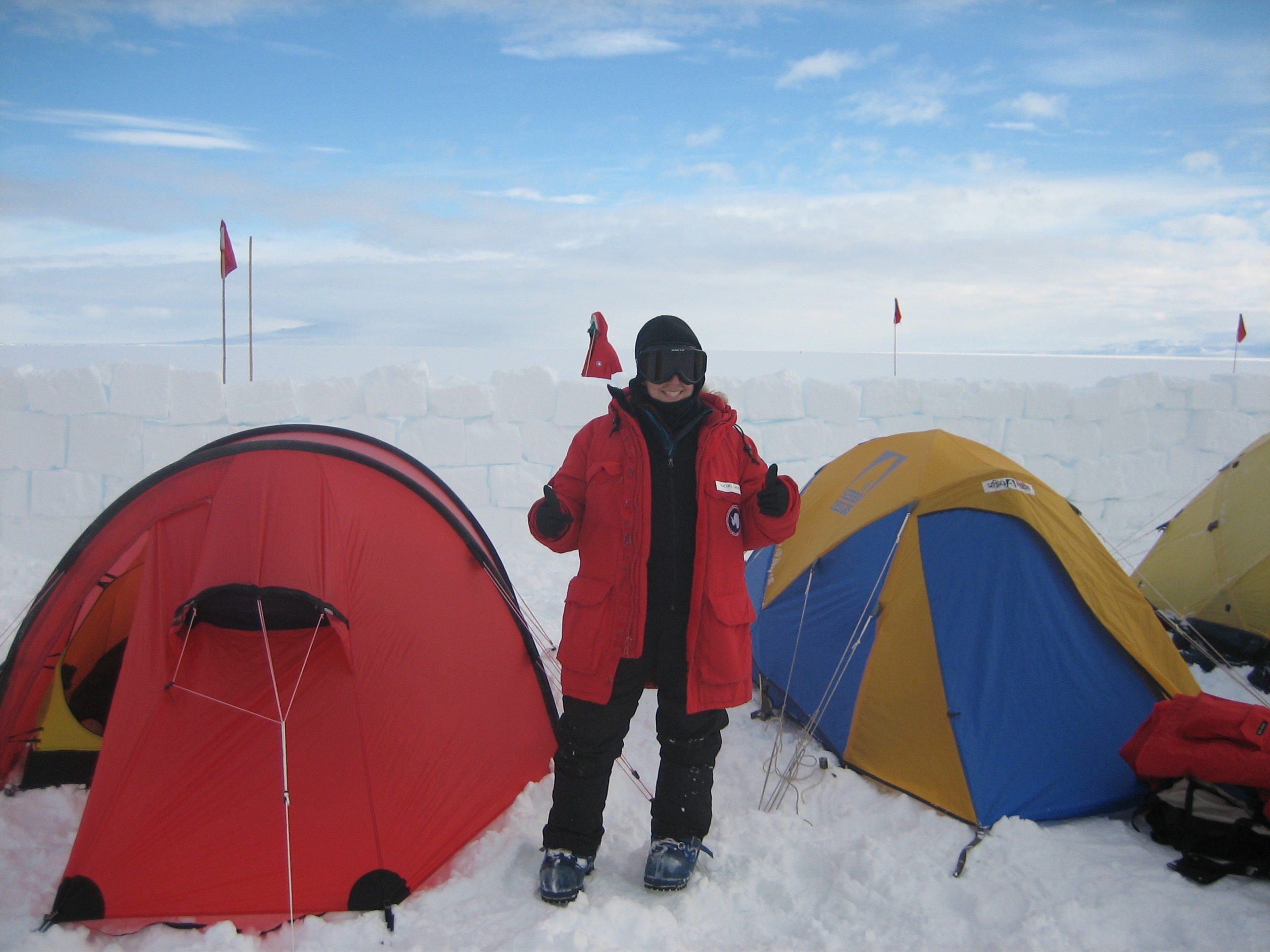 Your correspondent, officially a Happy Camper.
|
You may be thinking this all sounds interesting and exciting, but how exactly do earthquakes help us learn about the structure of Antarctica? Seismology is not strictly the study of earthquakes. Seismologists also use seismic waves from earthquakes to study the Earth. Just like an X-ray will expose details of the body invisible to the human eye, the behavior of seismic waves expose details of the Earth from the shallowest crustal layers all the way down to the core of our planet.
When an earthquake occurs, seismic waves travel through the Earth and are recorded at seismic monitoring stations. These waves move at different speeds depending upon the type of material they are traveling through. For example, a seismic wave will slow down when traveling through warmer layers. Seismologists can figure out how fast a wave is moving through different parts of the Earth by looking at the wave arrival time at a network of seismic stations. The more stations there are, and the more densely they are sited, the more detail can be observed about the underlying structure. By installing seismometers in Antarctica, we are able to figure out how the crust differs all points all across the continent.
Why do we care? It is important to understand the interaction between the ice sheet and the underlying bedrock. Think about placing a heavy weight on top of a thick sponge. The weight will create a depression in the sponge. But what happens when you remove this weight? The sponge will bounce back to its original shape. The Earth's crust behaves in a similar way, but areas of warm, weak crust depress much more than areas of strong, rigid crust when put under the same weight. As the ice melts and relieves some of the weight on the continent, the crust begins to move vertically like the sponge; that motion is detected by the GPS instruments. By combining seismic data about the type of crust beneath the ice with the GPS data showing the amount of vertical motion each year, geologists can improve their calculations of the scale and rate of ice melt. This has a direct impact on sea-level change. In a time when global warming is a hot topic in science, it is important to figure out how the polar regions of the world are being affected and what that may mean for the future.
Before I can travel to Byrd field camp, there are a few things I need to do to prepare for the extreme environment I'll be living in. I have spent this past week at the U.S. base McMurdo going through different training courses, including a snow school that is referred to around here as "Happy Camper." This hands-on two day training takes place on the outskirts of McMurdo, conveniently far enough away to discourage those who may have thoughts of walking back to the cozy base. Throughout the course we learned skills like how to use camping stoves, set up tents, erect snow walls to shelter our tents from the wind, build survival trenches for emergency situations, and operate a high-frequency radio. Although some of the more adventurous "campers" chose to sleep in their survival trenches, I opted to stay in a tent and learned some good tricks for keeping warm in the process. By putting two bottles filled with hot water inside my sleeping bag, I was very comfortable throughout the night and could also keep my hat, gloves, and neck guard warm for the next morning.
To wrap up the training we ran through some scenarios, including how to find a lost team member in the event of a white-out. This involved wearing white buckets on our heads so we were not able to see anything, which I'm sure is always entertaining for the instructors. The camping experience was surprisingly very enjoyable, especially because I had the opportunity to meet a lot of other scientists and learn more about other projects taking place in Antarctica. In the end I'd say I was a very happy camper and am ready to head to Byrd!
Stay tuned for Rachel's follow-up from Byrd camp. For more on POLENET and living the scientific life in the Antarctic, visit POLENET on the web.


