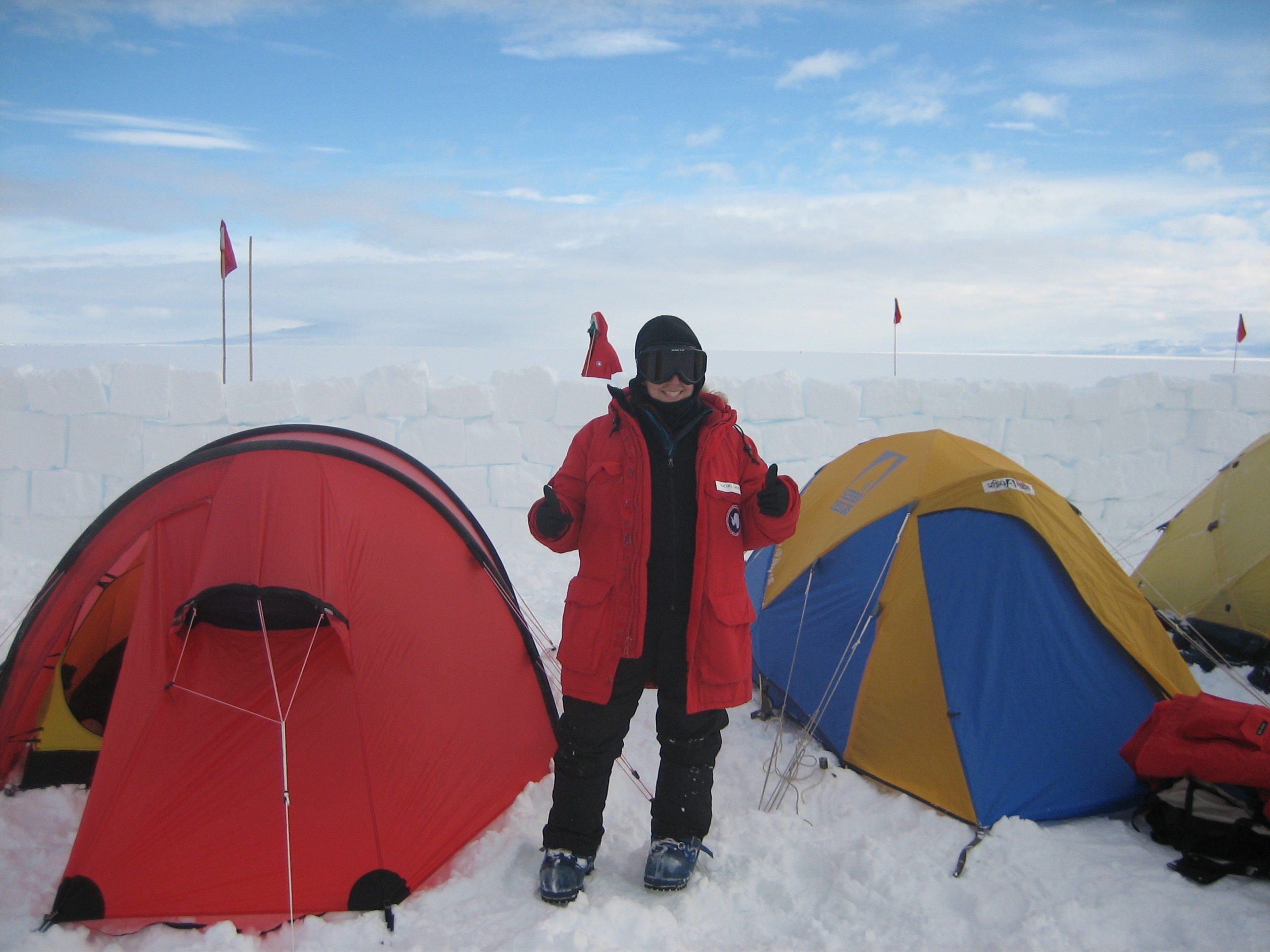
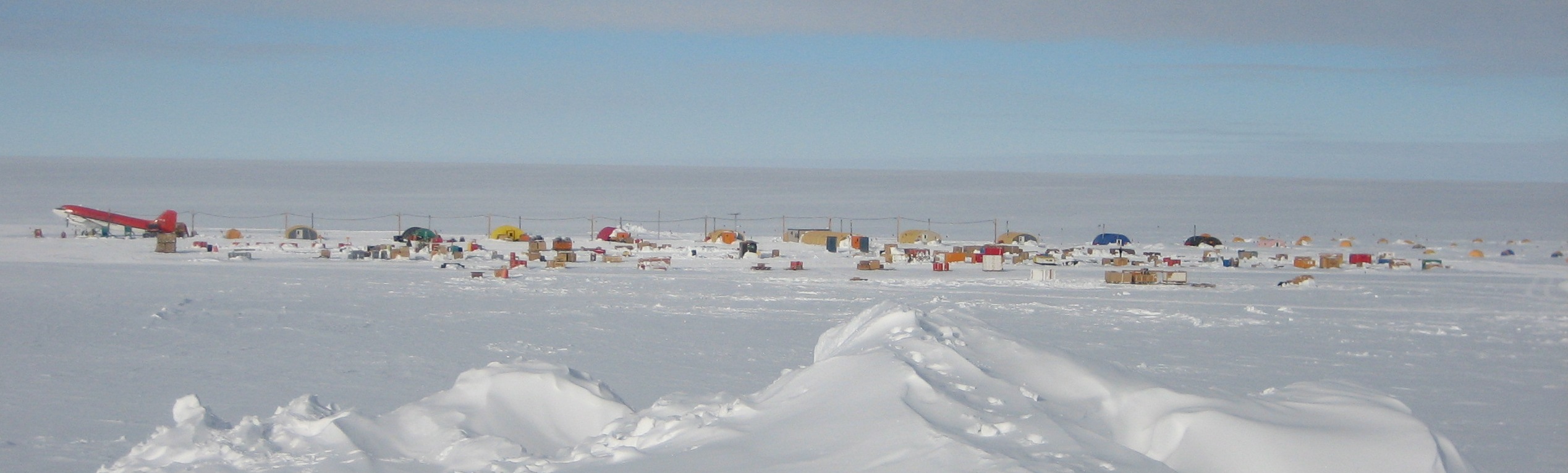
In the beginning of December, I arrived at Byrd camp in the middle of the West Antarctic ice sheet to begin working on the POLENET project, which uses a network of seismic and GPS equipment to reveal the structure of the continent and the behavior of the ice sheet. Byrd Camp is our base as we fly to sites around the continent where previous teams have installed stations. The remote camp is home to about 35 people. This includes the scientists working on POLENET, pilots from Kenn Borek Air who fly the Twin Otter and Basler airplanes to our sites, and a hard-working camp staff made up of weather observers, kitchen staff (who happen to be excellent cooks!), and people who do daily tasks around camp.
Camp itself is made up of several semi-permanent tents that house the galley, washroom (aka Byrd Bath), science equipment, and pilot sleep quarters, plus a meeting tent where we can watch movies and hold science lectures. Most of us sleep in "tent city," a big plot of mountain tents that is further away from the loud, heavy equipment used at camp.
 Byrd camp, my home sweet home in the Antarctic.
|
Each evening, the POLENET team gathers to figure out where we want to fly the following morning. The process is a little tricky because in order to fly, the weather must be good every step of the way: at Byrd camp, at the site we are flying to (which could be as far as 600 miles from Byrd), and at a fuel cache along the route in case the plane needs to re-fuel during the trip. If the weather forecast does not look good at any of these places, we'll be grounded.
To make things more complicated, the weather in Antarctica fluctuates rapidly, and the plan that we develop each night must often change in the morning when the pilots get an updated forecast. This makes for some hectic mornings of getting the right people and equipment organized to fly because the planes can only hold a certain amount of weight and the equipment needed varies from site to site.
While at Byrd, I visited six seismic sites. Some were only temporary stations that were installed a few years ago and needed to be removed completely from the ice. At other sites that are more permanent, we collect stored data and perform maintenance that will keep the stations running for another year. Although the setup of a seismic site may not look like much on the surface of the snow, inside all the buried boxes is an intricate suite of equipment that will record earthquakes from around the world. The following picture is of a temporary site that we had to completely dig out and remove.
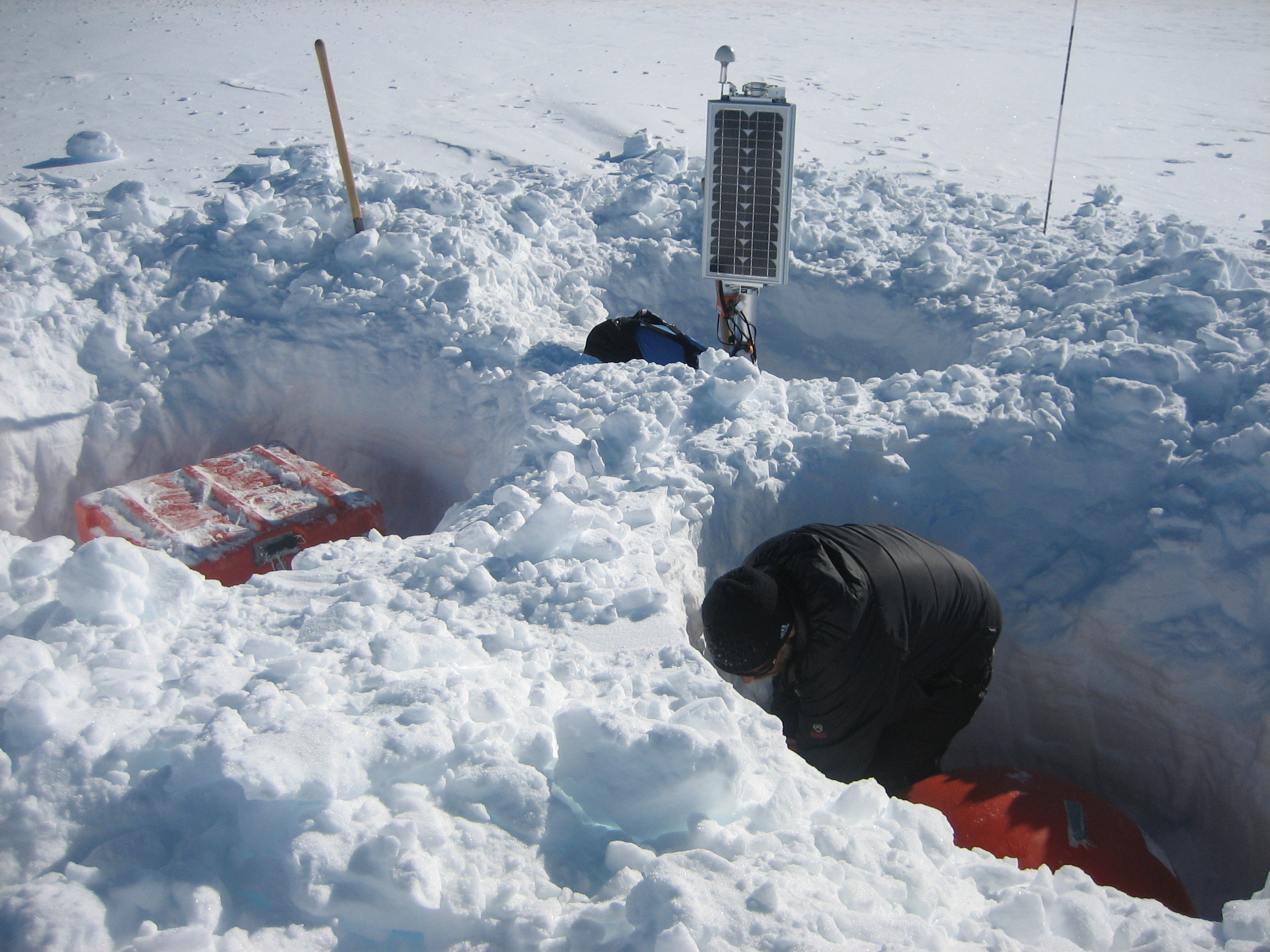 Digging out a temporary site...or preparing a five-star snow fort?
|
On the right side of the photo you can see a circular red dome. Under this dome is the actual seismometer, which is insulated in a foam box and buried to shield it from the wind. The sensor is extremely delicate and is composed of three masses in a spring-like system, each one positioned in order to record ground motion in either the east-west, north-south, or up-down direction. A cable runs from the sensor through the snow and into the orange box on the left side of the photo, where it connects to a piece of equipment called a datalogger. The datalogger records these movements as data that can be viewed on a computer. Several times a day, the datalogger will transfer the digitized data to a small box called a baler that contains memory sticks. When we visit a seismic site, we can remove the baler to get all of the seismic data recorded over the last year or two.
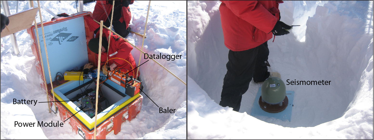 Inside the Little Orange Box.
|
But how do we keep this station powered up and running all year long in the harsh Antarctic weather? In the back of the station photo you can spot a set of three solar panels. A cable runs from these solar panels through the snow and into the orange box, where it is connected to a power module. The datalogger is also connected to this power module, along with 10 car batteries. During the six months of sunlight in Antarctica, referred to as austral summer, the solar panels keep the car batteries charged, providing power for the station. During austral winter when there is no sunlight, the batteries provide enough power to keep the station running. Just for comparison, when we install sites in other parts of the world we only need one car battery because the solar panels receive sunlight every day.
You also might notice an antenna on top of the solar panels. This is a GPS antenna that provides the time at the station. Without extremely accurate timing down to about a hundredth of a second, our data will be useless because we won't know how long it takes seismic waves from an earthquake to reach the station.
When everything functions correctly, we get excellent data. Below you'll see a signal from the earthquake that struck Japan on March 11, 2011, recorded at one of our seismic sites called Siple Dome. You can see how the earthquake looks on the up-down, north-south, and east-west components of the seismometer. We will use this data, along with data from many other earthquakes around the world, to make a map of the structure of the earth beneath Antarctica. Here's hoping that the rest of the data collected this season looks as good!
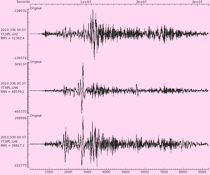 The March 11, 2011 earthquake, as seen by a POLENET station.
|