
|

|

|
Knocked off our Airborne Feet A Guest Dispatch: February 21, 1998 By NOAA research meteorologist Bradley Smull previous | next As a kid growing up on the High Plains of western Kansas, a region once traversed by huge herds of Bison but now visited principally by armadas of wheat-harvesting machines, I gained a deep appreciation for the importance of weather early on. The most carefully tended crop could be laid to waste in just a matter of minutes by wind-driven hail produced by towering thunderclouds each spring and summer. Upon visiting that starkly beautiful part of the world, a friend of mine remarked, "It's a place where the sky and everything in it are so large that they virtually envelop you." In fact, I can think of few better words than "enveloped" to describe the sense of being aboard a research aircraft as it is thrashed about the cavernous sky by buoyant updrafts and frontal wind shears that are at the very heart of a cyclone's power. It is at once a seductively exciting, yet tremendously humbling experience. 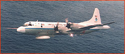 What drives my work as a research professor and scientist with
NOAA's National Severe Storms Laboratory is a desire to
understand weather in a tangible way—in the same way
that it impacts people worldwide on a daily basis—and
ultimately to reduce its toll on society. One can hardly
imagine a more tangible way to study a storm than to fly into
it, and we have had ample opportunity to do so during the
CALJET project (described in earlier dispatches posted by Mark
Hoover). We expected to have many opportunities thanks partly
to the active storm track carrying a bevy of exceedingly wet,
windy storms that typically intercept the West Coast of North
America at this time of year. But the frequency and intensity
of storms have probably also been aided and abetted by subtle
yet significant changes in the global atmospheric circulation
occurring during this record-setting El Niño winter.
What drives my work as a research professor and scientist with
NOAA's National Severe Storms Laboratory is a desire to
understand weather in a tangible way—in the same way
that it impacts people worldwide on a daily basis—and
ultimately to reduce its toll on society. One can hardly
imagine a more tangible way to study a storm than to fly into
it, and we have had ample opportunity to do so during the
CALJET project (described in earlier dispatches posted by Mark
Hoover). We expected to have many opportunities thanks partly
to the active storm track carrying a bevy of exceedingly wet,
windy storms that typically intercept the West Coast of North
America at this time of year. But the frequency and intensity
of storms have probably also been aided and abetted by subtle
yet significant changes in the global atmospheric circulation
occurring during this record-setting El Niño winter.Anyone who has even briefly considered the emotional and financial upheaval of having one's home besieged by a muddy debris flow, or tossed into the ocean by the unanticipated rapid advance of eroding coastal cliffs, can certainly appreciate the motivation behind our work in CALJET. Less apparent but equally important are the huge "hidden" costs. A storm that dumps eight inches of rain on the freeways of the San Francisco Bay Area during morning rush hour—as opposed to a few hundred miles north on the mist-shrouded redwood forests of northern California—creates unanticipated transportation delays, power outages and ensuing business/government closings. These are the sorts of common weather forecast errors that CALJET is aimed at reducing. The featured Storm Flight found elsewhere on this Web site does a fine job of describing the objectives and chronology of one of our very successful CALJET missions on February 2. This flight, in which the P-3 carried us hundreds of miles offshore from central California (where the storm would ultimately strike), was designed in part as a "proof of concept" test to evaluate the potential value of revolutionary new offshore observing systems to guard our vulnerable West Coast. Possible future observing systems include offshore moorings to house radars capable of detecting approaching jet streams and frontal circulations, and perhaps even un-piloted "drone" aircraft that could stay aloft for days at a time. The aircraft would drop sondes - miniature weather stations equipped with radio telemetry—that would collect special wind, temperature and humidity observations "targeted" to those regions of approaching storms thought to be most critical to how the storm will actually develop. Just one day after the mission highlighted in Storm Flight on February 3, we executed a complementary CALJET flight strategy focusing on the interaction between yet another storm front with the coastal terrain near Los Angeles. Not only do we use the P-3 aircraft to collect information in severe weather environments over remote regions not routinely sampled by any observing network, but by experiencing (or should I say enduring!) certain nuances of the atmosphere's and ultimately the aircraft's behavior, we are sometimes led toward important discoveries. For example, on the morning of February 3 we were tracking east at an altitude of only 1,500 feet through the Santa Barbara channel (bounded on the north by the coastline with its steeply rising Santa Ynez Mountains and to the south by the Channel Islands). Our attention was focused on a severe squall line that appeared to identify the front some 30 miles to the east. At the time I was shocked that, even as we entered the offshore airspace normally used by departing/arriving flights into LAX, the skies were open to virtually anything we wanted to do! In fact, Los Angeles air traffic controllers, who were generally annoyed at our complex and ever-changing flight track requests) seemed almost HAPPY to be talking to us! (The image of the forlorn Maytag repairman somehow came to mind...) I was jolted out of these musings as we were virtually knocked off our airborne feet by a radical shift in wind speed and direction every bit as profound as the front itself. Yet the front had almost certainly passed this site an hour or more before! We don't know yet what caused this surprising event, but I can say with confidence that a small flock of scientists will soon be poring over the data for clues! We later found out that the arrival of the severe frontal squall line—the sort that occasionally produces tornadoes over Los Angeles and other parts of southern California—had utterly closed down this huge international airport, yet another example of the importance of accurate forecasts of storms in this region. For over an hour we worked to document the strength and extent of the exceedingly moist southerly low-level winds hitting the Santa Ynez Mountains. At peak speeds of around 75 mph several thousand feet above the surface, these winds represented a veritable firehose pointed at coastal California. Later, as we did a reciprocal track around Point Conception and northward to Monterey, the awesome impact of this storm was apparent in numerous ways. The streets of Santa Barbara were a parking lot, inundated by runoff from heavy rains falling on already saturated soils. North of Point Conception, the lush hillsides were alive with narrow torrents and waterfalls where none should be, and the strip of sea immediately adjacent to the coast had turned an eerie yellow; soil that had once constituted those hillsides flowed into the ocean. We were seeing direct results of the powerful "low-level jet(stream)" that is CALJET's namesake. Though CALJET flight operations are continuing through the end of February, and winter storms enhanced by El Nino are expected to impact the West Coast well into spring, I have returned to the relatively peaceful confines of my office at the University of Washington. Nonetheless, from time to time my thoughts drift back to the challenges of my last few days in Monterey, which were punctuated by flooded streets, roads closed by mudslides, and widespread power failures that impacted our efforts to plan future flights even as they inconvenienced the broader population. It is perhaps worth noting that, as an increasingly technological society and one whose population is ever more concentrated along our coasts, we are all more and more vulnerable to such disruptions. Even MY long-scheduled escape from California was stymied, as my return flight out of Monterey bound for Seattle was delayed for hour after hour by pounding rains. As I sat in an airline terminal strangely devoid of airliners, pondering what I might share in this dispatch, an ironic fact struck me: I may be privileged to share a few of my experiences from studying the "business end" of El Niño during CALJET, but ultimately it is El Niño that will get in the last word! 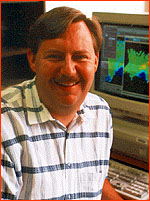 Bradley Smull is a research meteorologist with the
NOAA/National Severe Storms Laboratory and Research
Associate Professor in the Department of Atmospheric
Sciences, University of Washington
Bradley Smull is a research meteorologist with the
NOAA/National Severe Storms Laboratory and Research
Associate Professor in the Department of Atmospheric
Sciences, University of Washingtonprevious dispatch | next dispatch | table of contents Photos: (1) B. Smull; (2) R. Hueftle. Anatomy of El Niño | Chasing El Niño | El Niño's Reach Dispatches | Resources | Mail | Site Map | El Niño Home Editor's Picks | Previous Sites | Join Us/E-mail | TV/Web Schedule About NOVA | Teachers | Site Map | Shop | Jobs | Search | To print PBS Online | NOVA Online | WGBH © | Updated November 2000 |