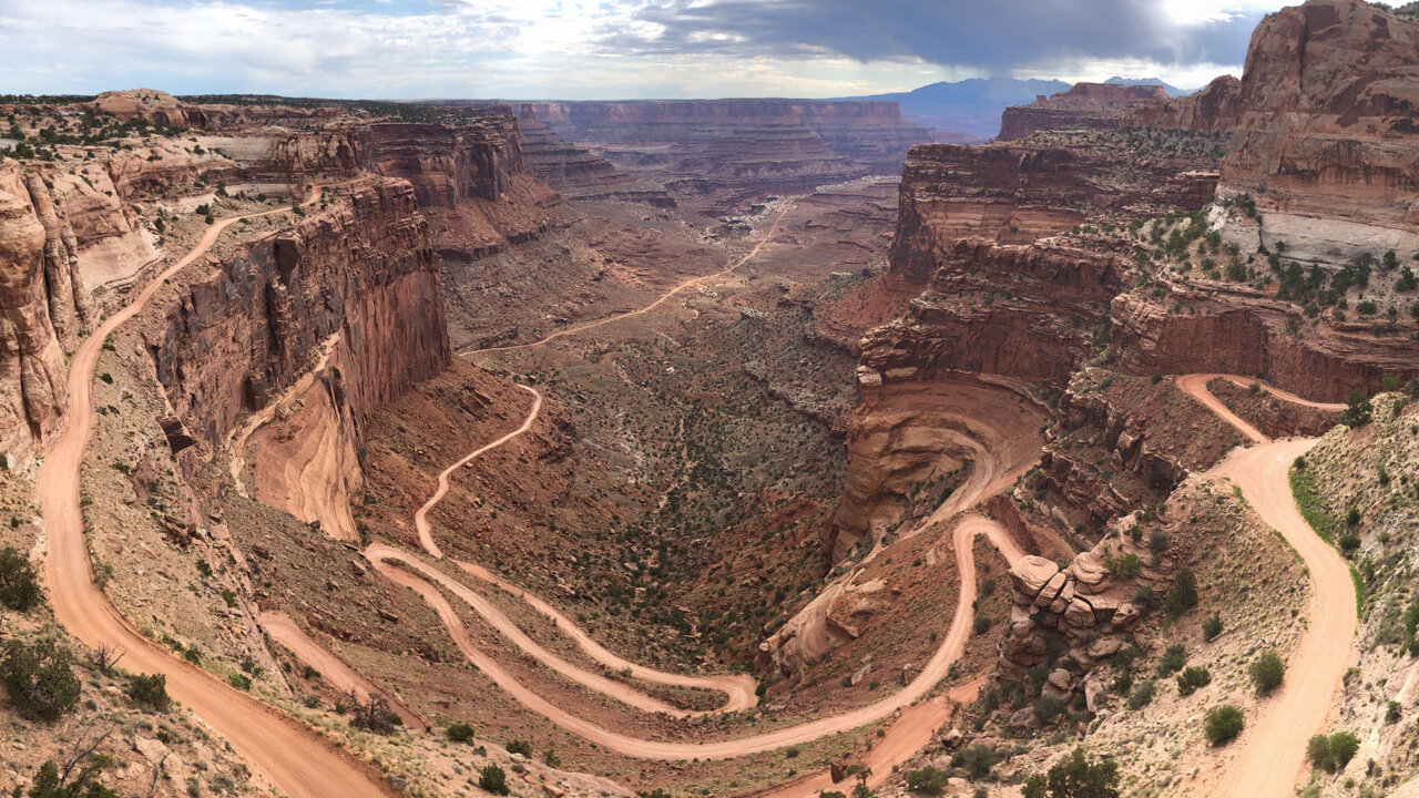
Image of Shafer Trail switchbacks from the Shafer Canyon Overlook. Credit: NPS/Collin Gilmore
Location: San Juan, Wayne, Garfield, and Grand counties, Utah, United States
Size: 337,598 acres (24th largest National Park)
Established: September 12, 1964 (31st National Park established in the U.S.)
Overview:
Canyonlands National Park preserves a dramatic landscape carved by the Colorado and Green Rivers in southeastern Utah. Within its 337,598 acres, the Park is divided into four distinct districts: Island in the Sky, The Needles, The Maze, and the rivers themselves. Towering mesas, sheer cliffs, buttes, spires, and winding canyons stand as evidence of the power and artistry of erosion and the timeless beauty of the desert.
Credit for the creation of the Park is owed largely to the work of Bates Wilson, former superintendent of nearby Arches National Monument (now Arches National Park). Wilson championed the need for a national park in the area that became Canyonlands. His persuasive “Dutch oven diplomacy,” which featured campfire conversations, Jeep tours, and shared meals, helped convince Interior Secretary Stuart Udall to advocate for the Park’s establishment. In 1964, President Lyndon B. Johnson signed legislation designating 257,640 acres as Canyonlands National Park. For further protection of the area’s unique beauty and grandeur, the Park was expanded to its current acreage in 1971.
Visitors may hike among colorful rock formations, paddle the rivers, drive rugged backcountry roads, or simply take in sweeping overlooks that stretch for miles. The Park’s remarkable geology, its dark night skies, and its sheer remoteness make it a place for adventure as well as stillness, where people can experience the desert in its raw and awe-inspiring form.
Carved by Time and Water — Canyon Formation
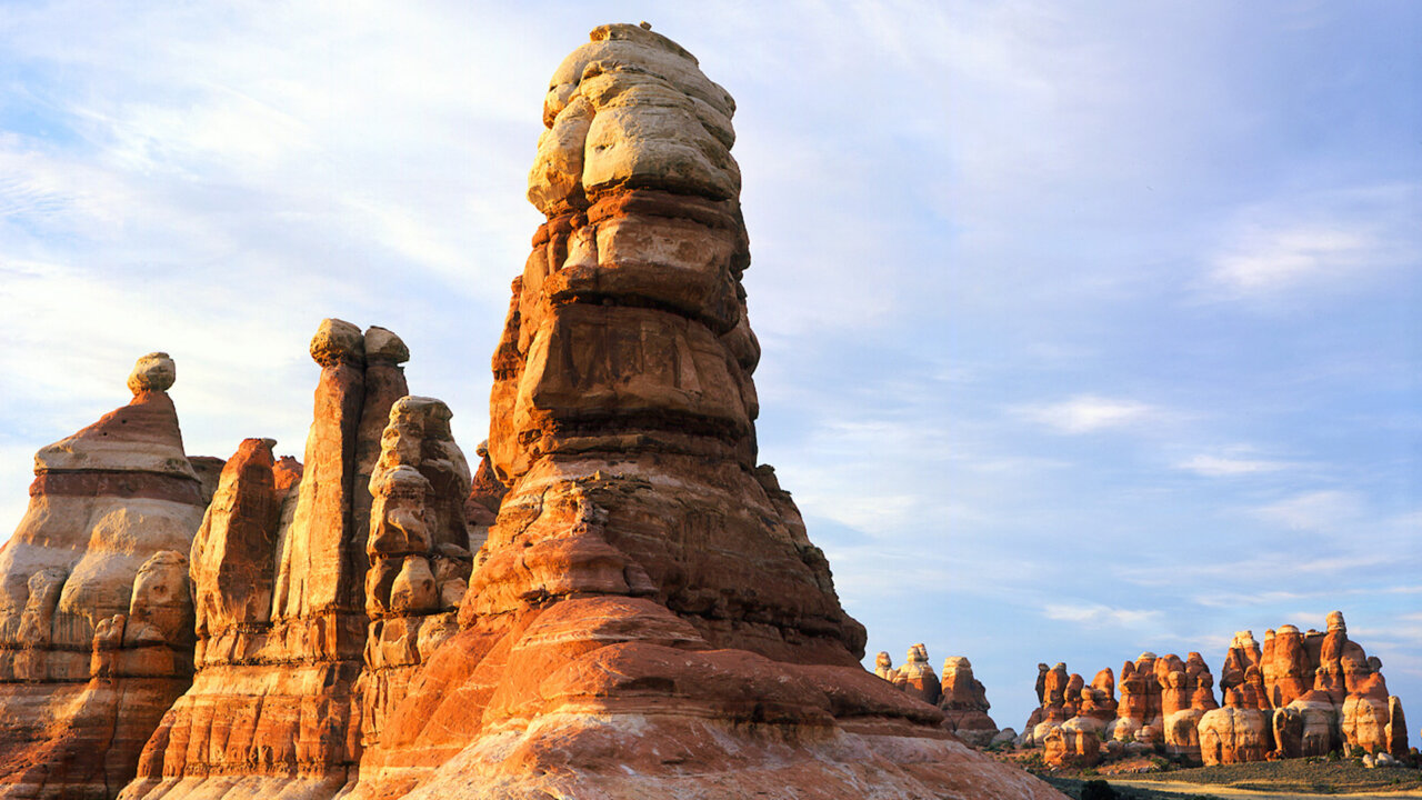
Colorful Cedar Mesa sandstone spires in The Needles district of Canyonlands National Park. Credit: NPS/Neal Herbert
Chapter 1: Deposition
The dramatic landscapes of Canyonlands began to take shape over 300 million years ago when inland seas, rivers, and ancient deserts covered what is now Utah. Sediment was deposited here — sediment carried by wind and water from ancestral mountain ranges like the Rockies and the Appalachians, building layer upon layer of sand, silt, and salts. These deposits eventually hardened into the colorful rock layers that now define the park.
The patterns and textures of the rocks, the layered colors and unique shapes tell the story of their geologic deposition. One example is the beautiful stripes of white and red found in Cedar Mesa sandstone, representing the mixture of white sands with iron-rich red sediment that originated in mountain ranges millions of years ago.
Chapter 2: Erosion
The carving of the canyons began much later, when the Colorado and Green Rivers started slicing through these layers following the uplift of the Colorado Plateau millions of years ago. Rain, snowmelt, and freeze-thaw cycles widened the cracks, while gravity displaced blocks of stone, creating the deep canyons, mesas, spires, and buttes that stretch across the landscape today.
Canyonlands is still being reshaped. The rivers continue to cut deeper, erosion gradually sculpts new formations, and today’s towering mesas may one day collapse into valleys — just as ancestral landscapes gave birth to the canyons we see today.
People of Canyonlands
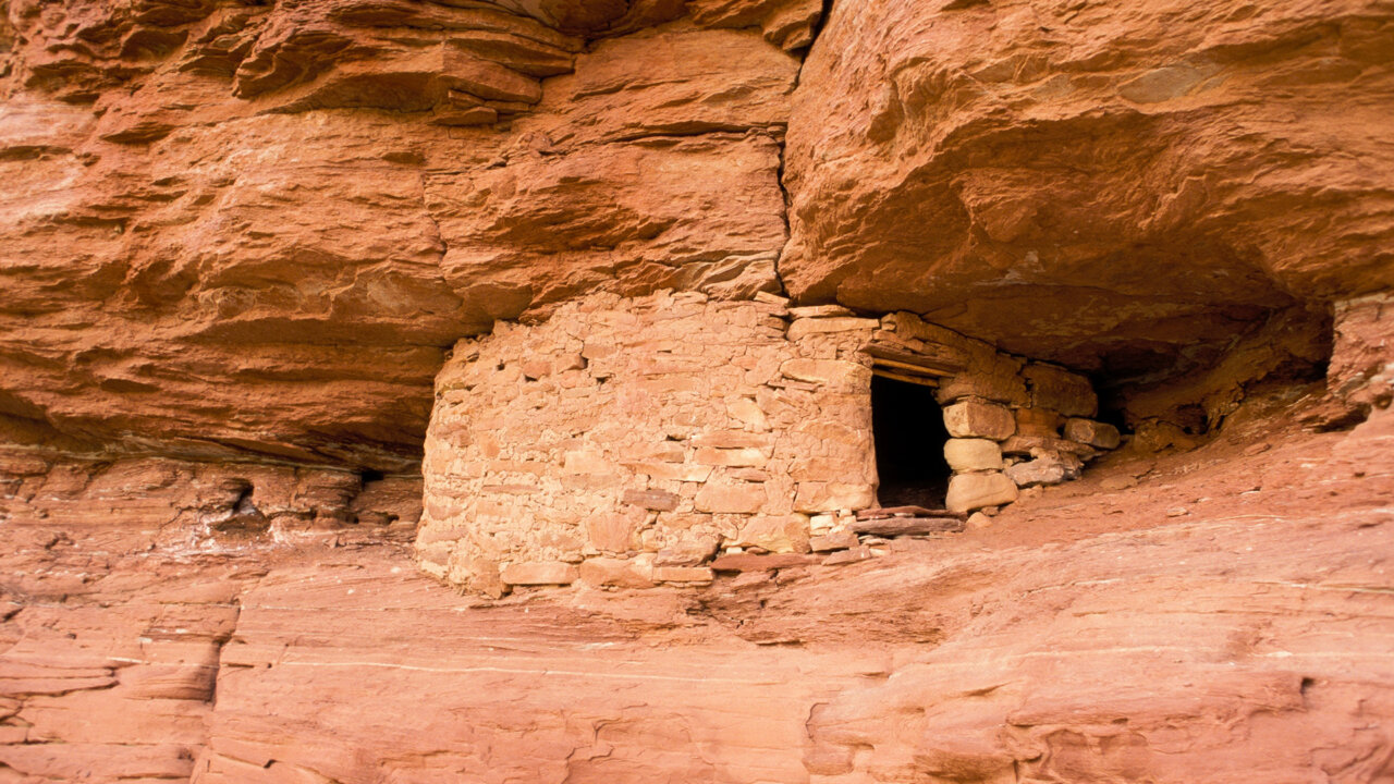
Ancestral Puebloan Structure. Credit: NPS/Neal Herbert
For over 10,000 years Indigenous people have lived and traveled through what we now call Canyonlands. The earliest visitors were nomadic hunter-gatherers who followed seasonal resources across what is now the Park.
As early as 2,000 years ago, certain hunter-gatherer groups transitioned to an agrarian lifestyle, growing maize (corn), beans, and squash. Two groups of these early farmers were the Fremont-era people and the ancestral Puebloans, each with their own distinctive culture. Although these peoples later emigrated from the area — around 1300 CE — evidence of their presence is still seen in petroglyphs, pictographs, and still-standing structures.
Many early European explorers, viewing the canyon country as virtually impassable, looked to indigenous people for guidance. In the mid-1800s, explorers like John Wesley Powell mapped the rivers, while Mormon settlers brought farming and ranching to the region. Cowboys used sites such as Cave Spring for water sources and camps, building trails and corrals whose traces survive today. By the mid-20th century, uranium prospectors were carving rough roads like White Rim Road, altering the landscape while leaving behind routes that later became recreation corridors.
The Districts
Canyonlands National Park unfolds across four distinct districts, each shaped by the Colorado and Green Rivers and each offering a unique desert experience.
Sunrise in The Needles. Credit: NPS/Neal Herbert
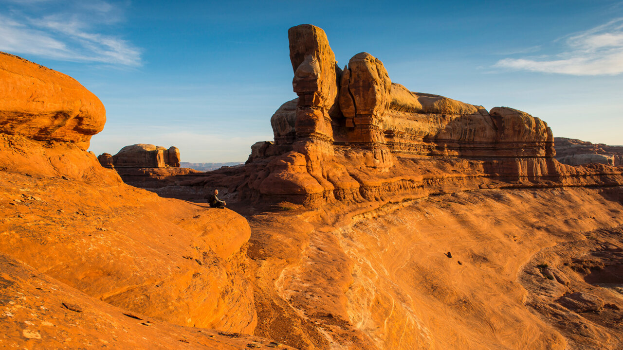
The Needles is named for its colorful spires of Cedar Mesa sandstone. This district is popular for backpacking and hiking among unique rock formations, with trails that also lead to ancestral Puebloan sites and rock art panels.
Island in the Sky sits atop a high mesa, more than 1,000 feet above the surrounding canyons. It’s the most accessible area of the park, with a paved scenic drive, overlooks like Mesa Arch and Grand View Point, a visitor center, ranger programs, and short trails perfect for day visitors.
The Maze is the park’s most remote and least visited area. With its labyrinth of canyons and rugged terrain, it is accessible only by unpaved roads and requires careful planning and self-sufficiency.
The Rivers is named for the Colorado and Green Rivers, which cut through the heart of Canyonlands, carving the dramatic canyons that define the Park. These waterways provide opportunities for both flatwater paddling and challenging whitewater rafting, offering a perspective of the landscape visible only from the water.
The Ground Is Alive!
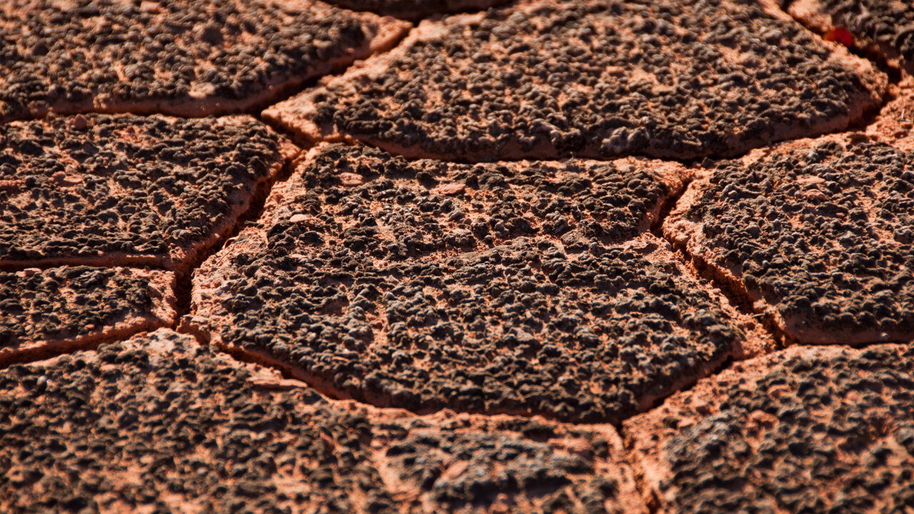
Image example of biological soil crust, vital to the desert ecosystem at Canyonlands National Park. Credit: NPS/Neal Herbert
Canyonlands sits within a cold desert ecosystem on the Colorado Plateau, where arid conditions, sharp temperature swings, and scarce rainfall create a challenging environment for life. In this seemingly barren landscape, a “biological soil crust” forms a living skin across the soil, stitching it together. This crust is actually a community of mosses, lichens, algae, microfungi, bacteria, and cyanobacteria.
These crusts are vital to the desert’s health. They bind soil particles together, preventing erosion from wind and rain. They also absorb and hold water while enriching the soil with nitrogen and other nutrients necessary for plant survival.
Despite their resilience to natural stresses, biological soil crusts are extremely vulnerable to human impact. A single footprint, bike tire, or vehicle track can crush them, setting back growth by decades. Fragile crusts may begin to recover in five to seven years, but mature crusts dense with mosses and lichens might take 50 years or even centuries to return. Their loss ripples across the desert, threatening plant communities, wildlife, and even water cycles.
Visitor Tip: “Don’t Bust the Crust!”
To protect the biological soil crust, visitors are encouraged to stay on marked trails, rock surfaces, and sandy washes when exploring Canyonlands. By protecting the soil crusts, we preserve the hidden ecosystems that sustain desert life for generations to come.
Adventure Awaits
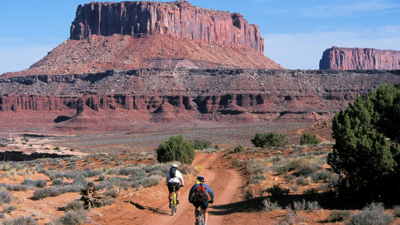
Recreational bikers brave the White Rim Road in Canyonlands National Park. Credit: NPS/Neal Herbert
Canyonlands offers a wide variety of ways to explore and engage with its dramatic desert canyons. Hiking trails range from quick mesa-top walks to extended backpacking treks. Or, visitors may enjoy auto touring via paved and four-wheel-drive roads.* For those seeking quieter pursuits, opportunities include boating (both flatwater and whitewater); rock climbing; horseback riding on backcountry trails; ranger-led experiences; and, after dark, some of the best stargazing around.
Spotlight: Mountain Biking the White Rim Road
Want to experience an epic adventure? The White Rim Road is a legendary 100-mile loop that circles and descends beneath the Island in the Sky mesa, offering expansive views of Canyonlands’ unique geology. Many bike trips feature three or four days of riding with thousands of feet in elevation change. The road is rugged, so expect steep climbs, exposed sections, loose sand, and rocky terrain.
***Fun Fact: There are actually no roads that connect the four districts of the Park! Navigating between districts can take two to six hours by car — so plan accordingly!
Sources: All images and data are public domain provided via the Canyonlands National Park NPS Site.
This piece comes to us from our nonprofit partner Post Pigeon EDU. With a mission to spark curiosity about the amazing nature in our public lands, Nature and Post Pigeon EDU are collaborating on a series of posts that will share the histories and stories of our National Parks.
More about Post Pigeon EDU: To ignite the next generation of planetary stewards, Post Pigeon EDU is a nonprofit organization working to increase exposure and access to the outdoors by bringing public lands and leadership into K-12 classrooms, virtually.