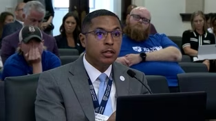
Kentucky Braces Ahead of Major Winter Storm
Clip: Season 4 Episode 307 | 9m 33sVideo has Closed Captions
Kentucky is on the verge of what could be its biggest winter storm in years.
Kentucky is on the verge of what could be the bigginst storm to hit the state in years. Governor Andy Beshear has declared a state of emergeny. Parts of the state could see double-digit snow totals. Others could see significant ice. Meteorologist Christie Dutton talks with the National Weather Service ahead of the storm.
Problems playing video? | Closed Captioning Feedback
Problems playing video? | Closed Captioning Feedback
Kentucky Edition is a local public television program presented by KET
Kentucky Braces Ahead of Major Winter Storm
Clip: Season 4 Episode 307 | 9m 33sVideo has Closed Captions
Kentucky is on the verge of what could be the bigginst storm to hit the state in years. Governor Andy Beshear has declared a state of emergeny. Parts of the state could see double-digit snow totals. Others could see significant ice. Meteorologist Christie Dutton talks with the National Weather Service ahead of the storm.
Problems playing video? | Closed Captioning Feedback
How to Watch Kentucky Edition
Kentucky Edition is available to stream on pbs.org and the free PBS App, available on iPhone, Apple TV, Android TV, Android smartphones, Amazon Fire TV, Amazon Fire Tablet, Roku, Samsung Smart TV, and Vizio.
Providing Support for PBS.org
Learn Moreabout PBS online sponsorshipYou know, we're on the verge of what could be the biggest winter storm to hit Kentucky in years.
Governor Andy Beshear has already declared a state of emergency.
As we look ahead to a combination of snow, sleet and freezing rain, and that snow could top one foot in some places.
On top of all that, we expect bitterly cold temperatures with below zero wind chills.
Our Christine is checking in with the National Weather Service.
So, Kristi, tell us, how much snow are we going to get?
Well, Renee, the amount of snow and ice we could see really depends on where you are in the state.
And I will have those snow total maps and the ice accumulation map coming up here in just a couple minutes.
But first, one thing's for sure.
The entire state now under this winter storm warning for the snow, the ice and the impacts that could have.
And it's warning us that now is the time to be prepared for this storm before these first snowflakes even start to fall.
And when that is again, it depends on where you are in the state.
This system is going to be moving from the southwest up toward the northeast.
So that means the first folks to see the snow from the system will be in Western Kentucky.
So early Saturday morning, 6 to 9 a.m.
Paducah starting to see that snow starting to fall.
And then from 9 a.m.
to about noon it's going to move up to Owensboro, Hartford, Bowling Green, and during the afternoon, noon to 3 p.m.
we expect to see that snow start to fall around Elizabeth Town around Louisville, Frankfort, Danville, Richmond, London, all the way down to Harlan.
And then from 3 to 6 p.m.
in the late afternoon, that snow will start to fall around Jackson, Pikeville, Maysville, and Northern Kentucky.
So earlier today, I spoke to the National Weather Service meteorologist Michael Koch, who says now that we're getting closer to the start of this winter storm, the forecast accuracy impacts and certainty of this winter storm are really starting to come into view.
So we're looking at the highest snow totals to be between Louisville and Lexington, kind of on the I 64 corridor there where you can see 14in or more of snow, which is a lot of snow coming in at once within that 30 to 36 hour time frame Saturday into Sunday.
But there's also a potential to a freezing rain, especially for southern part of Kentucky, and then over in the east in the mountains where we could see up to half an inch accumulation.
So you're talking very slick roadways, power outages, significant disruptions to daily lives.
Yes.
Freezing rain can do that.
So you said freezing rain is a potential for southern Kentucky when with the freezing rain come into play.
So what you've got going here is ice expected Sunday morning ending by Sunday afternoon.
But you have snow on Saturday, then the ice Sunday morning into Sunday afternoon and then into Sunday evening.
It will finish off that snow once again for Kentucky.
Okay, but not everybody is expected to see that freezing rain.
You are sort of tracking that freeze line.
So tell me, you said there's a no bus potential for this winter storm, but what could impact have a significant impact on the snow totals that you're predicting?
So you're absolutely right.
You're going to see a winter storm.
But the 32 degree line up above the surface can change a little bit.
And that's what we're watching very closely continuing to monitor.
But there's still some uncertainty kind of along the Bluegrass Parkway.
And southward a little bit where there could be a little bit of more snow or ice, depending on how warm the air gets above the ground level.
Yeah.
So that area needs to be prepared for just about anything.
So how do we prepare for this and what impacts should we expect?
If you're kind of stuck and not sure what to do.
Go to ready.gov slash kit.
Kit like emergency kit.
And there's great tips on there.
That's Ready.gov slash kit for if you're building the kit together or what you can have for this winter storm.
Thank you, Michael Kocher.
And we now have the latest updated forecast from the National Weather Service.
And you can see that bull's eye over the northern half of the state for the snow totals expected starting tomorrow through Monday morning.
We have over a foot of snow potentially for Louisville, Frankfort for northern Kentucky.
Those snow totals are really adding up.
Now where you see the yellow, we have a band of 8 to 12in of snow.
Morehead, Lexington, Richmond, Danville, Elizabethtown, also around Owensboro and Paducah.
Now here in the southern portion, the snow totals are a little less.
Look at this.
We have 4 to 6in inches around Pikeville, Russell Springs, Bowling Green, and even less there in far south eastern Kentucky.
And the reason why those snow totals are a little bit lower is because of the freezing rain potential in southern Kentucky, and that will cut back on those snow totals.
However, freezing rain can be extremely dangerous.
It can cause power outages and make travel nearly impossible.
We're expecting a period of freezing rain late Saturday night into early Sunday morning, so we're expecting snow first, then that period of freezing rain for portions in southern Kentucky and then changing back over to snow after that.
And where we see the quarter to a half inch potential for freezing rain.
That's where we expect the most problems with those power outages, trees and power lines down.
And also that can make travel on those roads very dangerous.
So something to keep in mind.
And if this wasn't enough weather information to handle well, we also go under a cold weather advisory tonight through tomorrow morning because these temperatures are already starting to drop.
We could have wind chill temperatures overnight below zero in many areas across the state.
So Renee, the cold, it's already on its way and the snow and ice will soon follow.
Oh goodness Kristie.
Well thank you our meteorologist Christine helping us out tonight.
We're also getting perspective from the Kentucky mesonet at Western Kentucky University.
It's network of automated stations monitors environmental conditions across the Commonwealth.
And our Laura Rogers has more on the expectations for the weekend.
Shane Holland is outreach manager at the Kentucky Mesonet at WKU.
And Shane, I consider you this encyclopedia of weather data and history.
So tell us the system that we're expecting.
How could this compare to weather events of the past?
Well, there's a good chance, Laura, that the snow amounts that we receive for this system, particularly for the northern one half of the Commonwealth, could rub shoulders with those that we're seeing.
Back in 2015, when we had two storms that essentially shut down the state, one of which occurred on Presidents Day, February 16th, 2015.
Double-digit snow amounts were coming across much of central Kentucky, including Lexington, from that event.
And then, lo and behold, just a few weeks later, on the evening of March 4th into the morning of March 5th, 2015, we had another, blockbuster event where we had 1 to 2ft of snow across a large swath of central Kentucky, especially along the Western Kentucky Parkway, through E-Town, and over toward Lexington.
And then one season later on January 22nd, 2016, or ten years ago yesterday, we had another similar snow storm that dumped over a foot of snow across central and eastern portions of Kentucky.
So there's a good chance that the amounts that we received from this prolonged event Saturday and Sunday, could be in line with those that we saw in the 2015 and 2016 events.
And then just to confirm, it sounds like we are expecting a little bit of everything at this point, along with cold temperatures, ice, snow, sleet.
Is that accurate?
That's correct.
This looks like mainly a snow event along the Ohio River, certainly for places like Henderson, Owensboro, over toward Louisville and up toward Covington and places that stay mainly snow could be looking at easily a foot, if not more, before this situation is over by Sunday night, where it gets more complicated, as in the central and southern parts of Kentucky, where some warm air will intrude aloft at least a couple thousand feet above the ground as we head into Saturday night.
And that could change is still what works for a mixture of sleet and even freezing rain.
We hope not to get a whole lot of glazing or freezing rain, because if we do, that's what clings on to the trees and the power lines and causes of power outages.
But that potential is there, especially for Bowling Green and points to the south and east, where anywhere from a 10th of an inch to a quarter of an inch of icing.
So that will also add to the snow removal process and making that more difficult as time goes on.
With Sunday and Sunday night.
Shane Holland with the Kentucky Mesonet at WCU.
We appreciate your expertise in this information.
Thank you so much.
Thank you very much, Laura.
Renee.
Thank you Laura.
Now you can keep up with weather conditions across the state in real time online at K-Y mesonet.org.
They have 80 sites fitted with webcams that update every five minutes, so stay safe and warm.
Bill Blocking FCPS from Raising Occupational Tax Debated
Video has Closed Captions
Clip: S4 Ep307 | 3m 42s | The bill sparked spirited debate on the Senate floor before passing along party lines. (3m 42s)
Bill Lowering Conceal Carry Age Clears Kentucky House
Video has Closed Captions
Clip: S4 Ep307 | 3m 36s | House Bill 312 would extend conceal carry law to adults aged 18-20. (3m 36s)
Providing Support for PBS.org
Learn Moreabout PBS online sponsorship
- News and Public Affairs

Top journalists deliver compelling original analysis of the hour's headlines.

- News and Public Affairs

FRONTLINE is investigative journalism that questions, explains and changes our world.


Support for PBS provided by:
Kentucky Edition is a local public television program presented by KET