
Severe Storms Cause Flooding, Outages in Kentucky
Clip: Season 4 Episode 411 | 5m 50sVideo has Closed Captions
A look at the damage across Kentucky caused by severe storms.
Many Kentuckians woke up to weather warnings, downed trees, flooded roads, and power outages. Heavy downpours continue for part of the state as flooding becomes the main concern tonight. Our Christie Dutton tells us who was hit the hardest and who may see more severe weather tonight.
Problems playing video? | Closed Captioning Feedback
Problems playing video? | Closed Captioning Feedback
Kentucky Edition is a local public television program presented by KET
Severe Storms Cause Flooding, Outages in Kentucky
Clip: Season 4 Episode 411 | 5m 50sVideo has Closed Captions
Many Kentuckians woke up to weather warnings, downed trees, flooded roads, and power outages. Heavy downpours continue for part of the state as flooding becomes the main concern tonight. Our Christie Dutton tells us who was hit the hardest and who may see more severe weather tonight.
Problems playing video? | Closed Captioning Feedback
Where to Watch Kentucky Edition
Kentucky Edition is available to stream on pbs.org and the PBS app.
Providing Support for PBS.org
Learn Moreabout PBS online sponsorshipMany Kentuckians woke up to weather warnings, downed trees, flooded roads and power outages.
Heavy downpours continue for part of the state as flooding becomes the main concern tonight.
Our Christy Dutton tells us who was hit the hardest and who may see even more severe weather tonight.
Kristie.
This powerful storm system moved through overnight into the early morning hours, leaving damage in many communities.
And even now, we still have several counties under flood watches and flood warnings.
Take a look at this map from the Kentucky mesonet, showing the maximum wind gusts over the last 24 hours, including when that storm system moved through.
We have wind gusts close to 40 miles an hour around E-Town.
Also around the Lexington area, 43 mile an hour wind gusts there in Mercer County, 50 to 60 mile an hour.
Wind gusts around Henry, Carroll, Trimble County.
And take a look at this right here.
A 114 mile an hour wind gusts.
That is Mason County in the city of Maysville.
That was recorded by the Kentucky mesonet weather station there.
If that verifies, that's going to be the second fastest wind gust ever recorded in Kentucky.
The first being from those Western Kentucky tornado that was in December of 2021.
Attached to many of these mesonet stations is a camera, and we got a hold of a two hour time lapse from that camera there in Maysville.
Things were relatively calm at first.
You can see.
But right as those winds pick up, right as the storm system moves through.
This camera was knocked off line right as it recorded that 114 mile an hour wind gust.
So they'll be out there fixing that.
Also out there right now is the National Weather Service doing damage surveys to determine if that's from straight line winds or if it's from a tornado.
Earlier today, I got to speak to our state meteorologist from the National Weather Service, John Wilson, about which communities bear the brunt of this storm.
So far, the areas that have been hardest hit, there are two distinct areas, one with more severe weather and then one with more flash flooding issues.
So the severe weather area, the one, where we could have potentially had some tornadic activity, if not for sure, strong straight line winds that was up in far north eastern Kentucky, specifically Maysville and Florence.
Both of those areas had at least strong straight line winds, if not, potentially a tornado or two in that part of Kentucky.
And then elsewhere.
We're tracking flash flood issues, and the main issues for that are further south of where the main line of severe weather was.
So from a line roughly from the Bardstown area all the way over into Madison County.
That's where we've seen the greatest rainfall totals anywhere from 3 to 4 plus inches.
That happened again all before, dawn this morning.
And, we've had reports of some road closures, some home flooding and, just various impacts related to that much rain that fell only over the course of just a few hours.
Okay.
And I know a lot of us woke up to tornado sirens or heard them early this morning.
Do we do you know of any areas that the National Weather Service will be going out to do surveys to determine if a tornado occurred or not?
Yes.
So the National Weather Service office in Wilmington, Ohio, their forecast area is actually in parts of northern Kentucky.
So they forecast for not only parts of Ohio and Indiana, but into northern Kentucky.
And that is the focus of where the tornado surveys are taking place.
So there's a tornado survey that's going to be taking place in the Florence area.
And then also another tornado survey taking place in the Maysville area.
And in addition to those two, if they have any other reports of damage that come in or if they notice looking back on radar data, if something looks like it could have been tornadic, they'll go back and survey those areas as well.
Let's talk about the flooding.
So there is still an ongoing concern with flooding and the rain in some areas, especially there in southern Kentucky, still falling.
What do we need to watch out for there?
The main risks area for flooding through the day will be in southern and eastern Kentucky, and any time we talk potential hydro issues in eastern Kentucky, it's always a big risk area with the terrain and that part of the state.
So, that's our biggest focus through the day today is southern and in particular eastern parts of the state.
Okay.
And I know National Weather Service always says turn around, don't drown.
You want to give one last reminder?
Yeah.
Turn around, don't drown.
And the reason is, is because you don't know how deep water is when you get into it.
If you can't see the ground below it, there's no way to really know how deep the water is.
And so the recommendation is turn around, don't drown, because it doesn't take that much water to cause a vehicle to not be able to pass through it and sweep a vehicle downstream.
Turn around, don't drown.
That is always great advice.
And hey, we're not in the clear just yet.
The Weather Prediction Center has the southern half of the state under a slight risk of excessive rainfall tonight through the overnight and early tomorrow morning.
So Renee, it is a reminder to make sure, especially if you're in the southern half of the state, to make sure you have a way to receive weather warnings overnight, even after you go to bed, either by a weather radio or by your emergency alerts on your cell phone.
Renee, back to you.
Thank you.
Our meteorologist, Christy Dutton.
Thank you for all of that.
Iconic Florence Y'all Water Tower Impacted by Storm
Video has Closed Captions
Clip: S4 Ep411 | 3m 12s | Severe weather causes Florence Y'all water tower to lose power. (3m 12s)

Police Chiefs Outline Crime Concerns During Meeting in Frankfort
Video has Closed Captions
Clip: S4 Ep411 | 4m 41s | Police chiefs from Kentucky’s largest cities urge lawmakers to support community policing efforts. (4m 41s)
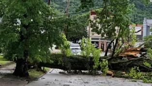
Storm Leaves Widespread Damage in Maysville
Video has Closed Captions
Clip: S4 Ep411 | 2m 45s | Maysville hit with high wind, causing damage across the city. (2m 45s)
Town Hall Shows Division Over Proposed Kentucky Data Center
Video has Closed Captions
Clip: S4 Ep411 | 5m 11s | TeraWulf details plans for massive Kentucky data center as community remains divided. (5m 11s)
Providing Support for PBS.org
Learn Moreabout PBS online sponsorship New Episode
- News and Public Affairs

Top journalists deliver compelling original analysis of the hour's headlines.

- News and Public Affairs

Today's top journalists discuss Washington's current political events and public affairs.




 New Episode
 New Episode
 New Episode

 New Episode

Support for PBS provided by:
Kentucky Edition is a local public television program presented by KET