Digging Deeper: Nebraska Drought
Special | 19m 28sVideo has Closed Captions
Backyard Farmer takes an in-depth look at drought and drought mitigation
Backyard Farmer takes an in-depth look at drought and drought mitigation with climatologist and geoscientist Brian Fuchs from the National Drought Mitigation Center.
Problems playing video? | Closed Captioning Feedback
Problems playing video? | Closed Captioning Feedback
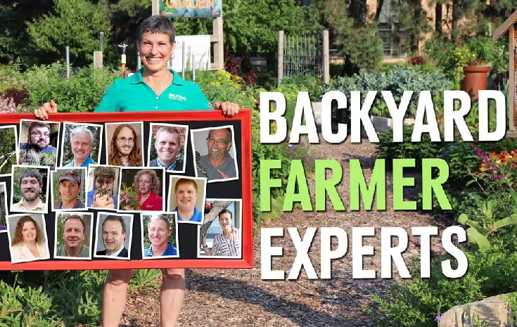
Backyard Farmer is a local public television program presented by Nebraska Public Media
Support provided by:

Digging Deeper: Nebraska Drought
Special | 19m 28sVideo has Closed Captions
Backyard Farmer takes an in-depth look at drought and drought mitigation with climatologist and geoscientist Brian Fuchs from the National Drought Mitigation Center.
Problems playing video? | Closed Captioning Feedback
How to Watch Backyard Farmer
Backyard Farmer is available to stream on pbs.org and the free PBS App, available on iPhone, Apple TV, Android TV, Android smartphones, Amazon Fire TV, Amazon Fire Tablet, Roku, Samsung Smart TV, and Vizio.
Join the conversation!
Looking for more information about events, advice and resources to help you grow? Follow us on Facebook to find exclusive content and updates about our upcoming season!(bright music) - Welcome to Digging Deeper with Backyard Farmer.
I'm your host, Kim Todd, and on Digging Deeper, we have in depth discussions with extension and industry experts about important landscape topics.
Tonight, we are talking about drought and it's mitigation with our special guests, Brian Fuchs, who is Climatologist with the National Drought Mitigation Center.
Did I get that right?
- That's correct.
Thank you for having me.
- Well, and Brian, as it always happens with these sorts of things we're talking drought after we've had sort of some massive rain events come through the state, parts of the state that actually were really, really suffering I think got a little bit, but that probably doesn't make any difference.
So I want you to talk about what is the National Drought Mitigation Center?
What do you do?
What can people do if anything about a drought situation?
- Yeah, so the National Drought Mitigation Center is actually within the School of Natural Resources here at the university.
And it was started in the mid to late 90's by Dr. Don Wilhite, and Don had the nickname of Dr. Drought.
That before Don came along and not too much research was being done with drought as a natural disaster.
And so he started a center here at the university and our current director, Marx Svoboda, was one of his first employees that he hired 25 years ago.
And what we really do is strive to teach people how they can better adapt to drought episodes, how they can identify that they're in a drought, so we call that drought monitoring.
Identify problems associated with drought, which we call drought impacts.
And then we also try to help them with the planning aspect of it, what can you do prior to a drought?
And all this research has gone on here at the university since it started.
And we have worked all over the country and also all over the world that with all the work that began with Don, it all has centered around his initial research, and it's kinda grown from that.
- Well I knew Don and actually I knew his wife, and he was passionate about this particular topic for very good reason, obviously.
And to be able to be...
Here we are in the middle of the country and in little old Nebraska that people kind of don't necessarily think are those sorts of research kind of possibilities doing national and international work.
So talk about drought monitoring, and talk about really the kinds of tools or what people can find on your website.
- Yeah, so on the website for the National Drought Mitigation Center, we actually have a separate website for our main tool and that's the United States Drought Monitor.
I'm one of the authors of that tool, and we rotate that through a partnership between NOAA, which is our weather service agency, as well as the USDA.
And drought monitoring really is looking at the various indices, the various weather data, the information that's out there and putting it all together into a single map, which many across the country utilize.
And what that map does is really puts drought into a perspective that as a decision maker, they can take that information and try to do the best job they can with the information presented, and they allow us to gather all that information together for them and putting it into a usable tool for them.
- So I suspect that a lot of our viewers have maybe seen a bit of the drought maps on the weather, especially as we are into extreme conditions or close and watching those colors unfortunately turn from green to bright red across the state.
How often do you update those maps and what is the technology?
What are the instruments that you use?
- So the drought monitor map is a weekly product.
And so it comes out every Thursday morning.
And the time period that we look at is Tuesday through Tuesday.
So a lot of times we'll get a big rain event, of course, on a Wednesday evening, like we did this week and people will look at the map and say, well, why didn't it change?
Well, we're gonna incorporate that into the next weeks.
And so what we do is we use ArcGIS and we bring all that different data right into a map platform.
So I can have the current map on the computer and then overlay the various data sets that we use.
And we use several dozen different data points, data pieces when we construct a map.
And then as the author, I manually remove those lines to where we see drought worsening or improving or changing the intensification, the data itself really drives that map.
And the more data that we've had available to us over the last decade or so we can really start drawing some of those contours with a little more precise accuracy because of the different tools that we have available to us.
- So let's define for our viewers drought.
'Cause is it dry, is it abnormally dry?
Gosh, it's dry.
What is drought?
- That's a great question.
And if we would have 10 people here and ask them to define drought, we would get 10 similar answers, but they would be kinda different because of how everyone interprets it.
If I'm a water supply manager versus someone in agriculture versus just a citizen, we would all have different perspectives.
But the way that we define drought is we look at the current information and we rank it compared to the historical data.
So we go back as far as the data set allows us to, and some data sets go back a 100 plus years.
Some maybe only go back 40 or 50 years, but we take that current information and we rank it.
So to be just on the map, it has to be in the driest 20 to 30th percentile, that's the yellow that we show on the map.
The first stage of drought is in that 10th to 20th percentile.
Then we have everything that goes all the way up to the first or second percentile for the very worst droughts that we show on the map.
So all that data actually corresponds to what we call a ranking percentile.
And then the methodology that we use allows us to place that drought intensity level that is directly reflected by the different data that we look at.
- Really interesting.
So I'm assuming that a big piece of that data set is actual rainfall or precipitation.
Is it intensity and duration?
How does the wind play into it?
How does the temperature... You know those factors are also interrelated.
As anybody who lives in a place where you have wind protection knows, or you don't.
So how are they interrelated to help you with getting that data to truly reflect well, the soil is dry or it's not.
- Yeah, it is complex, and a lot of times what we do look at is what that water balance equation looks like.
Back in the beginning of drought research, another Nebraskan, Wayne Palmer, developed the very first drought index, the Palmer Drought Index, and what that did was it tried to incorporate everything you just said, wind precipitation, soil, soil moisture, seasonality, and bring that all into a single value to monitor drought.
And we still do that today.
We still use the Palmer.
And we've developed other drought indices that try to do that as well, because we do know windy, hot conditions are gonna impact a landscape and water demand differently than if you're in a humid, calm, maybe cloudy situation.
And so we do take into account all those different data.
Some of 'em are into derived indices that look at drought that way, some of them we look at individually.
We do look at those rainfall amounts and we have folks on the ground measuring them.
We use radar estimates, we use satellite estimates.
We're trying to get as precise as we can, but all those different weather variables play into how we identify and measure drought.
- So audience, we wanna make sure that you are giving us good feedback on Digging Deeper with Nebraska, with Backyard Farmer in Nebraska.
We wanna make sure that you are telling us what you'd like to hear, yay or nay on such interesting conversations such as this.
Do you want more of this?
Do you want segments on this?
Do give us your feedback, because that is actually how we program this particular show.
All right, Brian.
So we kind of understand what drought is.
We kind of understand a little bit about the map and the factors that go into it.
The monitoring, what do we do about it?
What can people do about it and what...
I mean, the information that you provide through your particular center how is that used by farmers, by cities, by individuals?
- Yeah, that's a great question.
When I first started with the Drought Mitigation Center, the comment was, "Well, I already know it's dry, "why are you telling me something I already know?"
And as we've learned over time, especially in agriculture, it is a global type of occupation.
And so when you see that maybe the Southeast is in significant drought, which is a soybean producing area of the country, maybe a producer is gonna lean their bets towards, maybe I'm gonna put in more soybeans here in Nebraska because it looks like we have favorable conditions for that season this year.
The other thing that we see are for livestock producers.
When they're in drought, hay or feed is of essence.
And it seems like when you are in a regional type of drought, no one has any extra, there's no place to get it.
But you can find, oh, down in Texas, they've been in a good situation we can get some hay shipped up to us.
And we start using it as a marketing or a way to identify what we should be doing as far as planting or managing those agricultural concerns.
From a municipal point of view, having water information available to you.
And the drought map is a great way of identifying, okay, we're seeing it's really dry in the Rockies, and we know that most of that water that we anticipate down the Platte River isn't gonna happen.
So we can start looking at conservation efforts.
And that's always a key.
I tell that to everyone that, in a drought or not in a drought water conservation is something that we all need to participate in.
Water is finite.
We need to utilize every drop of water to the best that we can because we don't know if the current drought is gonna be one year, two year, five years, or it could be over next week, we don't know that.
And so you always kinda plan for the worst and hope for the best.
And a lot of the planning information that we have put together through the years, through the National Drought Mitigation Center really focuses on some of these ideas that you're not really looking at what you're doing in the moment, but really what can you do prior to the next drought.
When you're not in a crisis situation, you tend to make better decisions.
You tend to have more time to think through these opportunities of how you can better deal with the situation that may happen.
And so that's really what we strive to teach folks is dealing with drought before it happens is gonna be in your best trust.
- That's really a great thought and a perfect way to actually approach it.
So how far in advance, this is maybe kind of an odd question, how far in advance can you predict?
- Yeah.
You know, the joke about a meteorologist, right.
They can't get today's weather, how are we looking at something that's months down the road.
And for precipitation it is hard.
Precipitation is very difficult to predict with accuracy past one month really.
Temperature we can do a lot better with.
So what do we do?
We utilize the various computer models.
There's a lot of different modeling techniques that are out there that look at different things of the atmosphere, the land, how they interact.
And so what we end up doing is putting together all this information.
We don't do it here at our center.
There's a climate prediction center that they do this, and they actually do a monthly drought outlook and a seasonal drought outlook that kinda...
The seasonal goes out three months.
So the current one that came out last week takes us to the end of September and it kinda tells how is the drought map gonna change in that three-month period.
And the monthly drought does the same thing.
It comes out of the beginning of the month and says, for the month of July, which will be the one that comes out next week at the end of June, that how will the drought change in July?
Will it get worse, will it get better?
Will we see drought in areas that we don't currently see it?
And so all these computer models come together to bring in all that different information to just really show how will that national drought map change over the next one month or the next three month period.
- So how will it change for Nebraska?
- Yeah, of Nebraska we've kind of been teetering on the edge.
We have had some areas that have had some pretty good drought, especially up in the Northeast part of the state, as well as the Panhandle.
And it looks like, through the end of September, we're gonna kinda keep hanging on.
It looks like more drought is gonna develop in the Western part of the state, and even in the Northern, we're showing some of that.
But it doesn't say exactly what will the intensity be?
Will we just see some drought or more intense drought?
That's what we don't know.
But we're really gonna have to go through the rest of the summer in a similar situation of paying attention.
- [Kim] Right, so we have a 2021 drought map on the screen.
And so it's looking pretty red up there way north toward South Dakota.
- Yeah, up in Southeast South Dakota and Northeast Nebraska, to North Central Nebraska, that area has been dry since the fall.
And we've really watched it through the winter.
And as the map showing we see that red and some of that darker orange and that's severe and extreme drought.
And those are droughts that we typically only see once every 10 to 20 years or less.
And what we're seeing is, A, some of those places did benefit from some recent rains.
So we may see this be short-lived which would be good, but we've also had some severe weather with some of these areas and I've seen pictures of hailed out fields.
And so, do you stay dry or do you get the thunderstorms that bring you the moisture, but maybe severe weather.
For the rest of the state we're seeing more of that abnormally dry too.
We've recognized that it seems like we've had some months that have been quite wet and some months quite dry, normal would do well for us.
So well we are running a little bit behind, it depends on where you're at in this state, but we are seeing some areas just really drying out, and the warm temperatures of the last few weeks didn't really help that either.
- Yeah.
People or plants or animals or anything else didn't really care for that.
- Yeah, triple digits doesn't bode well for any of those wildlife or ecosystems.
- It does not.
So in terms of duration of drought, in your time here or even before, what is the longest extended period of abnormal or severe drought that has impacted the state.
- You know in Nebraska, there's been two episodes that really stand out.
The 2012 drought was the one that most people are gonna remember because it was the most recent, and that carried on all the way into 2014.
It developed in the summer of 2012, went through 2013.
And it was really in the 2014 before we saw the state really get back to normal.
The other episode was early in the 2000's, really a lot of the Western part of the state to the central part of the state had a multi-year drought event too.
And those are the things that we have to plan for that.
That's what makes my job very interesting is, we can have those very white years, like 2019, where the state was dealing with significant flooding all over.
And here we are in 2021 where we're talking drought over a large portion of the state.
And so again, the natural climate of Nebraska is we do have these changes.
We have very wet periods, we have very dry periods, and I guess we have to learn to deal with that change.
But right now, when we do see drought in Nebraska, it typically does stick around for awhile.
- Right.
We're not talking about a week's worth of not having water, we're talking a month.
- When it establishes itself, it's here for a while.
- Right.
So is the impact of a winter dry droughty set of conditions worse in your estimation or is it summer drought, or it doesn't make any difference?
If it's dry, it's dry, and that's just the way it is.
- You know, part of it is when it's dry, it's dry and it doesn't make a difference.
But there are key periods that we look at, especially in a state like Nebraska where agriculture is so important.
So after the harvest in the fall, until we freeze up, where the soils freeze up, that recharge period is very important to getting that moisture back in the soil that was depleted during the ag season.
So that's a key period that we look at.
And if you think about back to this last fall and into the winter, that was fairly dry.
And that's where we saw a lot of that Northeast drought establish itself, it was in Iowa and South Dakota as well.
And so we were really paying attention to those areas.
The winter precipitation, feet of snow, maybe will get you an inch of water.
And so even though we had snow like crazy, there wasn't always a lot of water associated with it.
Plus the soils are frozen, infiltration is hard.
So a dry winter isn't gonna make as big a difference as a dry spring or summer, but it still plays a part into that overall water balance, again, that we talked about.
And so, as we get into spring and summer, those are the crucial months.
Not only is agriculture in full production mode, especially once we get into June and July, those plants are needing about an inch of water every week, and that has to either come from precipitation, from the soils or through irrigation.
If you're a dry land producer you only get two of those.
And so it is a key in spring and summer that if we don't get precipitation we pretty much know that drought's gonna flare up and we're gonna be dealing with it in our state.
- All right.
Well, Brian, this has really been interesting and we're probably gonna revisit the topic with you, and we hope we get to do it in a situation where we're not in drought.
Where we can say, look at this the map is white, as opposed to red and yellow.
That is all the time we have for Digging Deeper with Backyard Farmer tonight.
We do wanna say thanks to Brian for coming in and talking to us today.
We will be back next time with another in depth discussion.
Do be sure to watch Backyard Farmer live every Thursday at 7:00 p.m. Central on Nebraska Public Media.
Thanks for Digging Deeper with Backyard Farmer.
(bright music)


- Home and How To

Hit the road in a classic car for a tour through Great Britain with two antiques experts.


Support for PBS provided by:
Backyard Farmer is a local public television program presented by Nebraska Public Media