
How the Thomas Guide Reveals a Changing Los Angeles
Clip: Season 9 Episode 1 | 8m 50sVideo has Closed Captions
The street atlas that defined how Southern Californian's navigated their city.
Before Google Maps, the Thomas Guide helped generations navigate Los Angeles. Created by the Thomas Brothers, its detailed grid system mapped a rapidly expanding city. Flipping through its pages reveals more than directions, it documents the growth of Southern California, from new freeways to sprawling neighborhoods, offering records of how Angelenos understood their city before digital navigation
Problems playing video? | Closed Captioning Feedback
Problems playing video? | Closed Captioning Feedback
Lost LA is a local public television program presented by PBS SoCal
How the Thomas Guide Reveals a Changing Los Angeles
Clip: Season 9 Episode 1 | 8m 50sVideo has Closed Captions
Before Google Maps, the Thomas Guide helped generations navigate Los Angeles. Created by the Thomas Brothers, its detailed grid system mapped a rapidly expanding city. Flipping through its pages reveals more than directions, it documents the growth of Southern California, from new freeways to sprawling neighborhoods, offering records of how Angelenos understood their city before digital navigation
Problems playing video? | Closed Captioning Feedback
Where to Watch Lost LA
Lost LA is available to stream on pbs.org and the PBS app.
Providing Support for PBS.org
Learn Moreabout PBS online sponsorship-If you're from Southern California, you know the Thomas Guide.
It was something idiosyncratic to the city.
In one way, it was a shibboleth of the city, right?
-Absolutely.
It was definitely almost a code word.
You knew who was in and who was on the outside, based on their reaction to the Thomas Guide, and how well they can use one, for sure.
-If you grew up in Southern California before Google Maps or Waze, you know the Thomas Guide.
The spiral-bound street atlas was practically a requirement for navigating a city too sprawling for any single map.
I brought my own well-worn copy, a 1974 edition, to the Los Angeles Central Library, where map librarian Peter Hague oversees the only known complete collection of the Thomas Guide's LA Orange County edition.
-That looks like a well-loved Thomas Guide.
-It is well-loved, and it's funny.
There are certain pages missing, and they're connected to what my father was doing.
He went to Cal Poly Pomona, so the page for that is missing because it was just used so much.
The page where my grandmother lived in Anaheim, also missing.
Look at this, right?
[laughs] Most of the atlases in your collection are in better shape, I would assume.
-I definitely try to keep them in better shape.
We have had a few Thomas Guides come to our collection that have been donations, so the condition of some of them can be a little bit questionable at times.
We have a few that do look like that.
-You could track the region's development through here.
-Yes.
-You could look at the 1974 edition, and there would be open space here, right?
The next year, 1975, there'd be a freeway going through there.
-Yes.
-You can probably trace a lot of the urban and regional development just through these Thomas Guides alone.
-Absolutely.
They're one of the most valuable tools that we have in the library for just that.
We'll have folks coming in all the time, and they'll want a very detailed, very accurate, year-by-year-- maybe every five years- looking at a certain neighborhood or a certain area of the city, and they want to see how it's changed, stack them one on top of the other.
Yes, you can absolutely see those changes take place.
It's pretty incredible.
-I wonder if we could do a little bit of that right now.
Can we look at some editions and see, let's say, one of the biggest regional landmarks, Disneyland?
Can we see before and after?
-Absolutely.
-Yes.
-Yes, okay.
-It opened in '55, so let's say the '54 edition.
Then let's look at one a couple years later.
-Sounds good.
Let's grab it.
[music] We should be right here.
You said?
-'54 and 56, Orange County.
-'54.
yes.
-These are some well-loved atlases.
These were not designed to be opened in the year 2026, right?
[laughs] -This is true.
This is very, very true.
Turn to map 16- -Yes, 16.
--of Anaheim.
-Orange County, yes.
This is two years apart.
This is actually astounding.
Just to look at the density of these suburban residential streets right here, totally missing two years earlier.
-Yes.
-Of course, the big one, the landmark, Disneyland, right here.
There's nothing to say that this will be the focal point of the amusement park industry in a year or so.
[music] One of the things that really fired my imagination as a kid was to look at just how freeways and actually, entire municipalities would just appear on the Thomas Guide.
I think a great example is to look at Irvine.
I think map 32 in Orange County.
This is 1954.
-[laughs] This is 1976.
-This is a 22-year difference.
Here you have almost nothing, right?
You have MacArthur Boulevard, still there in '54, but the campus of UC Irvine.
All of this Newport Beach Fashion Island -Fashion Island, yes.
-Yes, that's all missing here.
This was essentially Irvine Ranch cattle grazing land.
[music] This is thousands of hours of labor that went into this.
How did they put together these maps?
You couldn't drive every little street.
-They oftentimes did.
-Wow.
-Some folks would go street by street.
There was definitely aerial photography that was used.
I believe a lot of these were done by hand.
When we get into '92, we now have the intelligent map digitally published.
-I grew up on page 12.
[laughter] Here we have the 91 freeway, the 55 freeway, the 57, and of course, no freeways here.
This is the story that a lot of people experienced as they grew up.
They saw the region grow up around them, with them.
You can see it right here.
[music] You go all the way back.
What year is this?
-This is an interesting one.
This is a 1945 edition that we have, in amazing shape.
I believe this one may have appeared after excavating a really interesting story of map history in Los Angeles.
In 2012, there was a house that was being sold.
The occupant had passed away.
The realtor contacted my predecessor and told him that.
-Oh, the great Glenn Creason.
-The great Glenn Creason, absolutely, and told him that there was a house filled to the brim with maps.
-They weren't joking, were they?
[laughs] -They were not joking.
At the time, I was just a plucky young volunteer, lurking around, really interested in maps.
Glenn had my number, and he reached out to me.
I was so excited and said, "I need your help."
We went down to the house together, and we unloaded a house filled with maps.
They were under the bed.
They were under the mattresses.
I pulled out a stereo from the closet.
It was really interesting.
It looked really nice.
As I pulled it out, the weight didn't feel too right.
As I turned it around, the guts of the stereo had been pulled out.
Instead, it was just filled with maps.
They were everywhere.
-Because of that, for that, we have this.
This was, I guess, before they started making the glove compartment-sized ones, this would be to fit in a jacket pocket almost, right?
-Yes.
Which was a very common format at the time.
When folks were still messing around with these street guides and some of the best formats for them, you'll see folks carrying around things like the Renny guides, or even before that, Gillespie guides, have that very nice- -Oh, yes.
--pocket-sized format.
-That was the standard.
-Yes.
-Then the Thomas guide came along.
They figured, "Hey, this is something for the automobile."
-Yes.
-We can make the pages a little bit bigger.
-Make them bigger, make it a little easier to have out on your lap.
[music] -We call these Thomas guides, but the company was the Thomas Brothers, Thomas Brothers Maps.
Who were the Thomas Brothers?
-The Thomas Brothers, it was George Copeland Thomas.
He was the one you hear about all the time.
He was the one who started the company with his two brothers.
They were making maps up in San Francisco.
They started in 1915.
They were in the Oakland area.
They moved down to Los Angeles around the 1940s.
Before that, they were making wall maps.
They were making tourist maps that you might find, your standard fold-out maps.
-Their motto, "If it's a map, we have it."
-[chuckles] Yes, right.
The company was eventually purchased by Rand McNally, the big, big map makers, in 1999.
They're the ones who are still producing the maps today.
We still have Thomas guides as a requirement in emergency vehicles in California to this day.
[music] Some folks are critical of later editions.
They think they were better back in the olden days.
-[laughs] -I like the newer ones for just that very reason.
I think they've managed to give you a lot more information in a very unobtrusive way.
-Right.
-Having a lot of these neighborhoods highlighted is important.
-Yes.
Just look at page 633.
You have-- what?- five different neighborhood names here?
Here there's-- what?- a dozen?
-Yes.
We have Koreatown, Harvard Heights, Arlington Heights, Lafayette Square, Little Ethiopia, Jefferson Park, Centus.
-I haven't even heard of some of these.
[laughter] -What are your thoughts on just the mass migration over to digital maps, to GPS devices?
-It's easier.
I use GPS mapping all the time.
It's nice to have it tell you where you're going and all that, but I still carry a Thomas guide in my car I have.
-You do?
Wow, okay.
-I absolutely have the latest edition of the Thomas guide in my car.
I wish more people would.
I wish more people would explore the physical map because it's one thing to pull out your phone and look at where you are, but when you consult your own sheet of a Thomas guide, you can really have a much better sense of your own community.
Really see like, "Oh my gosh, hey, I didn't even realize I'm right around the corner from a school or police station," or what have you.
-Yes, you're part of a community that might be part of a page, but then you're also part of a region that's part of this atlas.
-Yes, absolutely.
I have definitely had folks still coming in today and they'll just say, "Do you just have a Thomas guide?
Do you just have a map?"
They just want something very simple that they understand and that are familiar with, and they are very happy to see that we still have those Thomas guides.
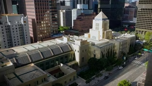
Surfridge, Tehachapi & Thomas Guide: How Southern California Moves (Preview)
Video has Closed Captions
Preview: S9 Ep1 | 30s | Nathan visits Surfridge, the Tehachapi Loop and the largest collection of Thomas Guides. (30s)
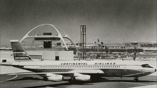
Surfridge: The Beachside Neighborhood Erased by LAX
Video has Closed Captions
Clip: S9 Ep1 | 9m 8s | A lost coastal neighborhood erased by the expansion of Los Angeles airport. (9m 8s)
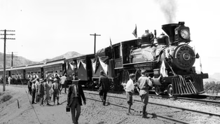
The Tehachapi Railroad Loop Still Powers California Trade
Video has Closed Captions
Clip: S9 Ep1 | 8m 40s | The railroad loop that transformed California trade. (8m 40s)
Providing Support for PBS.org
Learn Moreabout PBS online sponsorship





Support for PBS provided by:
Lost LA is a local public television program presented by PBS SoCal