Reimagining the Los Angeles River
Season 5 Episode 1 | 26m 40sVideo has Closed Captions
The L.A. River is reimagined through explorations of history, hydrology, and architecture.
The L.A. River is reimagined through explorations of history, hydrology, and architecture. Designs by local visionaries hope to transform the channel in new ways that benefit both the environment and people. But some residents along the river wonder if these changes will bring more harm than good to their communities.
Problems playing video? | Closed Captioning Feedback
Problems playing video? | Closed Captioning Feedback
Earth Focus is a local public television program presented by PBS SoCal
Reimagining the Los Angeles River
Season 5 Episode 1 | 26m 40sVideo has Closed Captions
The L.A. River is reimagined through explorations of history, hydrology, and architecture. Designs by local visionaries hope to transform the channel in new ways that benefit both the environment and people. But some residents along the river wonder if these changes will bring more harm than good to their communities.
Problems playing video? | Closed Captioning Feedback
How to Watch Earth Focus
Earth Focus is available to stream on pbs.org and the free PBS App, available on iPhone, Apple TV, Android TV, Android smartphones, Amazon Fire TV, Amazon Fire Tablet, Roku, Samsung Smart TV, and Vizio.
Providing Support for PBS.org
Learn Moreabout PBS online sponsorshipNarrator: The LA River, one of the largest infrastructure projects in the US, 51 miles of concrete controlling a river that once flowed freely across the Los Angeles Basin.
For many years, Angelenos have seen the river as a dystopian landscape or a set for Hollywood action scenes.
But today, the river is a critical site for envisioning the future of the region, and a new L.A. County Master Plan is asking big questions.
Can we re-engineer the river to be a livable oasis?
And can we do this without displacing the communities who call the river home?
These questions aren't just about the future of the river, but the future of the city itself.
[Music playing] Announcer: "Earth Focus" is made possible in part by a grant from Anne Ray Foundation, a Margaret A. Cargill Philanthropy, and the Orange County Community Foundation.
Narrator: For the last few decades, an almost mythological vision for restoring the LA River has captivated Angelenos.
Inspired by the soft-bottom, tree-filled stretches of the Glendale Narrows, we've imagined a river freed from its concrete shackles, a lush, blue-green ribbon running through the heart of the city.
Enter LA County's new Master Plan, an over-500-page vision document that addresses a sweeping range of issues, from flood protection and water management to housing and homelessness.
The Plan is groundbreaking for trying to address so many issues at once, but the core question at the heart of the Plan can be stated simply.
How can we transform the river channel from a piece of single-use infrastructure into a multi-use one?
To understand what's possible on the river, we first have to understand how we got here.
When people talk about the origins of the river channel, they often start with the flood of 1938, which killed at least 87 people, destroyed a ton of property, and caused city leaders to panic.
But it wasn't the first destructive flood on the river.
It was more like the last straw.
After the flood, the city, county, and Army Corps of Engineers came together to embark on a decades-long project to master the river.
Technologically, channelization was a massive feat of engineering, but socially, the construction of the channel had long-lasting consequences for those living near its banks, which hemmed communities of color into industrial corridors, where they suffered from polluted air, toxic industrial sites, and lack of green space.
And while the channel did its job and prevented flooding, after 50 years, people began to question its logic.
In the 1990s, a movement emerged arguing we should restore the river to its natural state.
Spearheaded by poet Lewis MacAdams, activists demanded that we re-center the river in public life, and they convinced a generation of Angelenos to care about the river.
They were so successful that river restoration became official city policy under Mayor Eric Garcetti.
But following through on this vision has proven difficult because rethinking the river at scale means grappling with how the channel was designed, and one of the best ways to see this is to take a ride with Mark Pestrella, the Director of L.A. County Public Works, and Marty Adams, General Manager and Chief Engineer of LA's Department of Water and Power.
Pilot: Helicopter DWP will be lifting off of the Water and Power Building, northwest of the 101 towards Cahuenga Pass.
Pestrella: Now, where are we flying right now?
Pilot: So, yeah, looks like we're on our way toward the headwater of the LA River here.
Pestrella: Take a look at this.
Interesting.
That's Canoga High School.
Can count that as the start of the Los Angeles River, formerly.
It's a confluence of two rivers coming together.
The river itself is sort of the backbone river, but there are many tributaries.
In fact, the land area that you can see from air, about 835 square miles, when it rains, lands on the surface, and all that water makes its way eventually into the LA River.
Talk a little about the geology of this area.
We'll talk about the weather, too.
I mean, the geology is, the San Gabriel Mountains here is one of the youngest mountain ranges and the fastest-growing in the United States.
It's granitic, it's made of granite, and it crumbles when it falls apart.
And what happens is we get these major storms, it pushes the granite down into the valley, and it built up this huge layer of granite and rock, which acts as a beautiful, natural filter for water.
And then all of our water-- typically, the majority of our water in the basin here is stored underground in groundwater basins.
Adams: Yeah, because we have these groundwater basins that are basically just the eroded rock, yeah.
Pestrella: Think of a carbon filter in your house, you know, how they stick that on the faucet?
Adams: Right.
Pestrella: It's the same thing.
Adams: Yeah.
Pestrella: So, most of our rain comes in the wintertime, as people know, and those storms are coming from the north, and they wrap up the front side of these mountains, stop the storms, hold them up, and they dump their water on almost at 10,000-foot elevation.
So you can imagine how fast that water is flowing because the steeper the terrain is--and that's what we get to see from the air, is how steep LA actually is--the steeper the terrain, the faster the water flows, and then water is very heavy.
It weighs 62.4 pounds per cubic foot.
That's like the size of a basketball, so imagine the size of a basketball that won't compress hitting you.
So that's why it's dangerous.
It's also good for us to be able to see at this scale up high is like, "Wow, that is a huge area being drained."
The river was designed for a hundred-year event.
In our hundred-year design event, you would have something like 185,000 CFS.
That would be 185,000 basketballs full of water flowing by every second.
Adams: Every second, every second?
Pestrella: Every second.
Adams: Every second.
Pestrella: For the scientists and engineers, that's a scary thing because that weight of that water going that fast across the surface of where people live can have absolutely devastating effects.
Adams: Well, you know, two things strike me.
One is that it makes it challenging to manage the water.
We've done a great job of getting rid of floodwater quickly, so that we don't have flooding here in LA, but at the same time, there's this, you know, the idea of what can we do in the future?
What can the river really be?
Pestrella: Yeah.
Adams: So, well, you know, what's going on with the Master Plan on that?
Pestrella: Well, the Master Plan is interesting.
It's the, you know, accumulation of many years of thinking about what the river could be, and that's essentially took not only a look at the river itself, the ribbon of the river, but it also looked at, like, the land uses along the river and what we could do to integrate the communities' land use with a, you know, urban river running through it.
Adams: Yeah, and then the other piece, I don't think anyone thinks that it's going to look like a giant, blue ribbon because that never occurred in LA.
It was not natural, and I don't think anyone's looking to be... Pestrella: Yeah.
Adams: something that isn't natural.
They're looking to be something that's--that was closer to natural and appropriate, which is--in LA is more of an intermittent, dryer river system.
Pestrella: You know, I love that because a lot of people have strong opinions and a vision like you just gave, there's actually some people with influence in Los Angeles that keep pushing for that, but when we went to the community, they wanted to learn about what was LA in its natural state.
The community has reached out and said they're--especially in our areas--the underserved areas has said they have a right, as you said, to access to the river... Adams: Right.
Pestrella: into a healthy environment to play and participate in their daily lives, and my vision and the vision of the LA River Master Plan is that we would achieve that in some--like you said, in, like, some 50 years.
Narrator: Of all the projects in the Master Plan, the proposal for the Rio Hondo Confluence is the most ambitious.
Located at the intersection of the 710 and Imperial Highway, there are 12 projects planned, including a cultural center and two large platform parks that would be built over the river channel.
These projects were designed by the team at Gehry Partners and Olin Studio.
Here, the dreams of removing the concrete ran up against the reality of the channel system, which became a surprising learning process for Frank Gehry and his team.
Gehry: So I looked at it, and there was a group called FOLAR, Friends of the Los Angeles River, that was run by Lewis MacAdams, and Lewis and I talked and he still, when I first met him, believed the concrete could be taken out, and that could be created into a beautiful, idyllic landscape that connects 51 miles of the city.
In our study, I looked at that for two years.
I believed you could do it, too.
It seemed like such a right thing to do.
It had to be true.
It had to be the right way to go.
Our values were similar.
What a wonderful man.
What a wonderful vision.
Unfortunately, it had no reality.
He was led to believe that you could take the concrete out.
I don't know who led him to believe that.
It certainly wasn't the Corps of Engineers.
It certainly wasn't the water districts or anybody.
Maybe it was wishful thinking.
Man: We started the project as similar to many people who have worked and continue to work on the river, which is this idea of a 51-mile connected green space, which is still our goal.
It's just a matter of what's possible.
Our Corps colleagues on the project were Jessica Henson at Olin and Mark Hanna at Geosyntec, and Mark is one of the foremost experts on the hydraulics and hydrology of the Los Angeles River, and he really had to give us an education on how the hydraulics worked.
[Music playing] Henson: And so we come here to the LA River, you see this, like, what, 400-foot-wide concrete channel, and you're like, "I'm a landscape architect.
We are going to make it vegetated and green, and it is going to be, like, cool.
Like, who doesn't want a green river, right?"
And so we started building, like, these 16-foot-long models of a widened channel, of different terraced options.
You start to look at it and you start to see some of the issues with that.
Hanna: Well, right, of course.
Most of the time you come down here, and this is what you're looking at, and you really feel like the opportunities to make moves are enormous.
It's those very rare events that you really need the channel to function the way it was designed.
Rivers in nature are not straight.
They meander, right?
They meander based on their flow rates, based on the vegetation conditions, based on the sediment load, and the slope of the actual channel itself.
So people look at this and say, you know, "Why can't we green this river up?"
And, really, greening this river up means bringing back those meanders.
And this river is a piece of infrastructure that was built to move water as quickly as possible.
If the idea when the flood control system was really developed, they were thinking, "We also want trees, we also want groundwater recharge, we also want open spaces and places for people to wander and experience nature," this channel would have been much larger.
They would have pushed back the levees much wider.
Henson: So if you bring this into where we are today, in the 21st century, we have a lot of critical infrastructure along the river, we have a lot of residents, like, a lot of people live along the river, and they love that.
By and large, the LA River is very tightly hemmed in, and so one of the struggles with saying, "Let's take all 51 miles and create that more natural condition" is it would cause a lot of displacement.
You'd be talking about displacing maybe tens of thousands of people if you did it for all 51 miles.
But the problem with it is, as a river, it's a system, and when you widen a river in a section, it's--the water slows down, so water stacks.
And when that water stacks, you create usually other flood issues for people upstream or downstream.
So you start to get into this situation of like, OK, well, this neighborhood gets this widened river, vegetated amenity, and then we're going to actually make flooding worse for this community just downstream, and they're not going to get a park.
And so it starts to become a real equity issue along the Los Angeles River as we stand here in our current conditions of the 21st century.
Historically, across the United States, communities of color have disproportionately borne the burden of that type of displacement when freeways have been built, when other infrastructural systems have been created, and unfortunately, we would see that repeated if we did something at that scale along the Los Angeles River.
So what innovative things can we do to bring that into the 21st century in a way that's actually going to support local communities, not displace local communities?
[Birds chirping] Takemori: The challenge for us, and I think what we did accept is the condition that we have today, right or wrong, is the condition that we have to address.
Huge amount of communities, especially underserved communities, are built right to the river.
You can't make the river wider and they need park space.
What can you do?
And they don't have a lot of vacant land in which they could build park space elsewhere, so the logic of creating new land over the top of it, it came out of that kind of "What else can we do?"
So, here, these are just some general plans of kind of the area.
This shows some of the key infrastructure pieces that are all kind of confluencing around here between the Rio Hondo, the Los Angeles River.
This is where the new Metro line, the West Santa Ana branch would go.
This plan shows the proposed idea for the Rio Hondo Confluence Area Plan, so the Cultural Center here sits embedded within 12 opportunity projects of open space, from a wetlands project, redeveloped power line right of ways.
You can see one of the platform parks of the Rio Hondo, the platform park over the LA River, each of them defined by what works hydraulically, and then connection bridges for the project at the north and south side that go over the freeway to connect the local communities to all of these new improvements, which is about 120 acres of new open space.
[Music playing] Gehry: I think the 51 miles, with the proper sense of creating these parks on top, you could create a beautiful landscape.
You could bring water out of the channel up to the top and create lakes for recreation, you can create rivers.
You could clean the water, put it back in the aquifer, so you would recapture water that we don't recapture now.
The payoff for the whole thing is incredible.
Takemori: So we worked for, really, the better part of almost 4 years, 3 1/2 years, all pro bono.
Frank's still pro bono to this day, and then, at the beginning of 2016 is when the genesis of the Cultural Center started to emerge.
By that point in time, we had started this heavy database research in terms of where underserved communities were in our region.
And the Southeast Los Angeles area came up on every map from every criteria, from public health statistics to income to rent burden.
The list goes on and on.
So this is an 1/8"-scale model of the SELA Cultural Center.
So starting up here on the north, this is Imperial Highway here, and you can see the levee in the river here in the foreground.
And so the project is laid out as a series of buildings that are organized along kind of a main working art street, and so the kind of centerpieces are also some of the outdoor spaces.
There's a main 500-seat music performance center with an outdoor plaza next to it that eventually, we hope, would be connected to the levee and eventually a connection across the river.
And then, as you kind of make your way down here, there are 3 galleries that are organized here, one of which would be of the class-A conditions to bring masterworks here to the location desired, and then there would be some arts education facilities and a bookstore.
In the middle here is a café with kind of a teaching kitchen.
This is one of the interesting things that we found out when we did talk to the community that affected the program, is that there was a high interest in the culinary arts, and the café and food is always a great attractor for people to come to kind of a location.
Gehry: When I started looking into this, the mayor of South Gate, they came to me with his 8-year-old son and told me that this boy had a 10-year-shorter lifespan because he didn't have access to park space.
"Please help us, Mr. Gehry," so I said if I could do it, I would.
I don't need to be--have it branded with my name.
I don't--I'd be much happier if it was a beautiful park winding through the city, connecting parts of it.
I mean, it's not going to be perfect, but the result is going to be pretty great, so it's worth some of these risks, I think, because what's the alternative?
10-year-shorter lifespan?
Narrator: The risks are on the minds of many residents in southeast L.A. After decades of disinvestment, the gateway cities want and need the Cultural Center and green open spaces.
But with Gehry's involvement, some fear a wave of real-estate speculation that would drive up rents, forcing out the people these projects are meant for, and threatening lifeways that have been nurtured along the river for generations.
[Music playing] Man: My name is Jose Calderon, and I've been here for, like, 20 years, family been here for over, like, 30 years.
We ride horses all our lives.
I'll be on the riverbed with my horses, dogs, walking, on a bicycle, but nothing compared to riding horses.
I do this every Saturday and Sunday.
Like, I'll be here sunset, sunrise, like, I'll be here, feeding my animals.
Like, I got goats, chickens.
I mean, being here is just, like, away from the city.
It's just another--it's another world, like, it's peace.
Just relief, like, stress reliever, like, I don't know.
There's no words to describe.
[Music playing] Woman: So the southeast region is predominantly Latino.
There is multilingual families, of course, but the majority of this region is low-income communities.
We do have one of the largest population.
It's close to 50% that younger generation, the 0-to-25 age group.
Then, in terms of housing, it's predominantly renters, which is really key as you think about, you know, again, economic prosperity of this region.
So, as you think about the Master Plan, right, it is really informing a number of investments across all 51 miles of the river.
Our community is continuing to elevate the concerns and the fear that our community feels of what we've seen in other communities, right?
As you invest, that causes displacement, it could cause gentrification.
So what does that mean for a community that's 80% renters, that really, you know, loves this community and has been here for so many years, but now we fear this investment potentially having other impacts, right, to our community?
And I think that's some of those concerns that our community members continue to have, like, what does this mean for us, right, as a community member?
And those are the conversations that can be very challenging, but I think are necessary.
[Distant music playing] Woman: My name is Laura Cortez, and I am a member, organizer, and co-Executive Director with East Yard Communities for Environmental Justice.
So I grew up around toxic pollution and toxic infrastructure, and I didn't know it for most of my life.
I run regularly.
I live next to the Rio Hondo River.
I grew up biking along the Rio Hondo and the LA River with my family.
The LA River is a great example of where inequity lies in terms of investments.
On my route, I run into a metal-coating facility, I run into a refinery, I run into a landfill.
Many companies have come into our communities.
Frank Gehry is an example of that, but there are many others who know that there are investments coming to this community, and so they are now coming into this community, but they are not from this community, nor are they prioritizing the voices of this community.
So we engaged through the process of the Master Plan.
We gave feedback multiple times.
Ultimately, we pulled out of the Plan because we were not being listened to, and this is very common of what we see in many Plans, is we have agencies, structures that do community engagement, that collect community feedback, but then don't actually put it in the Plan.
Franco: So the LA River Master Plan, it's a vision, but when you think about implementation, how do we make sure that as we think about investment in the Southeast, it's equitable community engagement?
We're really thinking about things like affordable housing, workforce development.
There's a very large small-business population, so what does that mean for them, and how do we protect them as well?
Cortez: For East Yard, we have supported and worked on the Lower LA River Revitalization Plan.
One of the highlights of that Plan for us was the Community Stabilization Toolkit.
The reason that toolkit is important is because it acknowledges that there will be displacement with capital coming into these projects, and so we understand that we need protections for the existing community.
And so a lot of what's in that toolkit includes rent control, tenant protections.
It includes no net-loss housing, so we don't lose any homes when we build the river out.
It includes community land trusts.
It includes working with local businesses to make sure they don't get displaced or priced out.
There are many other tools, but I think what I want to highlight here is that the toolkit is critical to protect those most vulnerable, those most critical to continuing the culture in our community.
That is what the Community Stabilization Toolkit brings to the table, and so, to be engaged and not have things like a Community Stabilization Toolkit, that's very disappointing.
Franco: I think the one thing in comparison to other regions that we're still growing in is the trust between the elected officials and government and the nonprofit sector.
Government needs the nonprofit sector, and nonprofit sector needs to push and hold government accountable, right?
So a lot of our community members may get frustrated with the process, the length of the process because we want better communities for our children now.
We don't want to wait another, you know, 20, 30 years, but we also want to make sure that this is for our community members that already live in these communities.
Calderon: I mean, rent, everything's going high, you know, like, I'm not gonna lie.
Everything's high right now, so that's why a lot of people started moving out, like, searching somewhere else, like to Perris, San Bernardino, Bakersfield, Delano.
Yeah.
Probably be here for another couple years.
Narrator: Like southeast LA, many communities along the river are at a historic inflection point.
The question now is, how will they shape the river that runs through their lives?
Takemori: The river started to become like a CAT scan through our local society, in a way.
It touched all the things you would expect that are water-based and ecological-based, but it touched a lot of societal things, such as affordable housing and homelessness and equity.
And so the river, I think, offers an opportunity to start at a big enough scale that it feels like it's possible.
Franco: How communities' voice is included in this process also requires political will, it requires our elected officials to really listen to what we're saying and really thinking in partnership with community, right?
Because a lot of these challenges that the community is experiencing are going to take different types of thinking.
Takemori: It doesn't mean that we can snap our fingers and solve it all instantly.
It just means that we shouldn't discount making improvements in our region and communities simply because we have not completely solved these issues yet.
Cortez: If we do nothing, it will have beautiful, green space, and there will also be no people of color or indigenous people.
That's what will happen if we do nothing, and so it is critical to keep pushing, it is critical to challenge these projects to do better.
[Music playing] Announcer: "Earth Focus" is made possible in part by a grant from Anne Ray Foundation, a Margaret A. Cargill Philanthropy, and the Orange County Community Foundation.
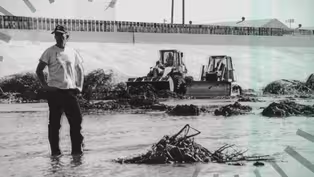
A Century of L.A. River History
Video has Closed Captions
Clip: S5 Ep1 | 1m 15s | The L.A. River's reputation has evolved, from raging waterway to industrial corridor. (1m 15s)

Frank Gehry Designs SELA Platform Parks and Cultural Center
Video has Closed Captions
Clip: S5 Ep1 | 3m 12s | Frank Gehry's team has proposed a cultural center and platform parks in South Gate. (3m 12s)
L.A. River: What Would Happen if Concrete is Removed?
Video has Closed Captions
Clip: S5 Ep1 | 5m 24s | How realistic is the dream of a 51-mile connected green space along the L.A. River? (5m 24s)
Reimagining the Los Angeles River (Preview)
Video has Closed Captions
Preview: S5 Ep1 | 30s | The L.A. River is reimagined through explorations of history, hydrology, and architecture. (30s)
Providing Support for PBS.org
Learn Moreabout PBS online sponsorship

- News and Public Affairs

Top journalists deliver compelling original analysis of the hour's headlines.


Support for PBS provided by:
Earth Focus is a local public television program presented by PBS SoCal